Highway 203 | ||||
|---|---|---|---|---|
| Ruta 203 | ||||
| Expreso Chayanne[1] | ||||
| Route information | ||||
| Maintained by Puerto Rico DTPW | ||||
| Length | 6.7 km[2] (4.2 mi) | |||
| Major junctions | ||||
| South end | ||||
| North end | ||||
| Location | ||||
| Country | United States | |||
| Territory | Puerto Rico | |||
| Municipalities | San Lorenzo, Gurabo | |||
| Highway system | ||||
| ||||
Puerto Rico Highway 203 (PR-203), also known as the Expreso Chayanne (after the artist who lived in San Lorenzo, Puerto Rico, as a child), is a highway which connects Gurabo, Puerto Rico at PR-30 with its parallel route Puerto Rico Highway 183 in San Lorenzo. It is the main route to San Lorenzo and is about 7 kilometers long. It is a dangerous highway, as steep grading is present going down and then going up.[3][4]
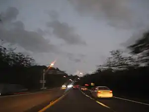
 Puerto Rico Highway 203 in San Lorenzo
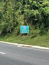
 Puerto Rico Highway 203 south in Gurabo
Major intersections
| Municipality | Location | km[2] | mi | Destinations | Notes |
|---|---|---|---|---|---|
| San Lorenzo | Hato | 6.7 | 4.2 | Southern terminus of PR-203; partial cloverleaf interchange | |
| Quebrada | 3.5– 3.4 | 2.2– 2.1 | At-grade intersection | ||
| Gurabo | Rincón | 1.0– 0.6 | 0.62– 0.37 | PR-Unnamed road – Senderos de Gurabo | Diamond interchange |
| 0.0 | 0.0 | Northern terminus of PR-203; PR-30 exit 5; trumpet interchange | |||
| 1.000 mi = 1.609 km; 1.000 km = 0.621 mi | |||||
See also
References
- ↑ "Ley Núm. 198 de 2012 -Para designar con el nombre de Elmer Figueroa Arce "Chayanne" a la Carretera Estatal PR-203 que conecta desde la Carretera Estatal PR-30 hasta la PR-183 en el Municipio de San Lorenzo". LexJuris (Leyes y Jurisprudencia) de Puerto Rico. Retrieved 29 March 2019.
- 1 2 Google (28 February 2020). "PR-203" (Map). Google Maps. Google. Retrieved 28 February 2020.
- ↑ National Geographic Maps (2011). Puerto Rico (Map). 1:125,000. Adventure Map (Book 3107). Evergreen, Colorado: National Geographic Maps. ISBN 978-1566955188. OCLC 756511572.
- ↑ "Tránsito Promedio Diario (AADT)". Transit Data (Datos de Transito) (in Spanish). DTOP PR. p. 104. Archived from the original on 1 April 2019.
External links
 Media related to Puerto Rico Highway 203 at Wikimedia Commons
This article is issued from Wikipedia. The text is licensed under Creative Commons - Attribution - Sharealike. Additional terms may apply for the media files.
