Highway 60 | ||||
|---|---|---|---|---|
| Ruta 60 | ||||
| Avenida Dionisio Casillas | ||||
| Route information | ||||
| Maintained by Puerto Rico DTPW | ||||
| Length | 3.55 km[1] (2.21 mi) | |||
| Major junctions | ||||
| West end | ||||
| ||||
| East end | ||||
| Location | ||||
| Country | United States | |||
| Territory | Puerto Rico | |||
| Municipalities | Humacao | |||
| Highway system | ||||
| ||||

Puerto Rico Highway 60 (PR-60) or Avenida Dionisio Casillas is a 1.9-mile-long (3.1 km) freeway entirely located in Humacao, Puerto Rico. It connects Puerto Rico Highway 30 to Puerto Rico Highway 3 and has two exits:
- PR-198, Humacao Centro: Access to Hospital Ryder, one of the most important hospitals in Humacao; Downtown Humacao and East Las Piedras
- PR-924, Antón Ruiz: Access to Downtown Humacao and barrio Antón Ruíz.
History
The freeway was part of PR-30 before the latter, then called Puerto Rico Alt Highway 30 (or ramal), ended in the intersection with PR-909 near Mariana. When PR-53 was under construction, PR-30 was also extended to its terminus and the Department of Transportation and Public Works of Puerto Rico (DTOP) renumbered the final 1.9 miles (3 kilometers) of former PR-30 to PR-60.[2]
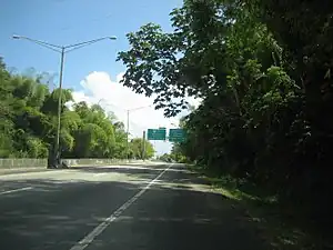 PR-30 approaching PR-60 in Humacao
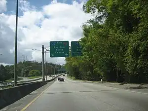 PR-60 going west to PR-30
Exit list
The entire route is located in Humacao. All exits are unnumbered.
| Location | km[3] | mi | Destinations | Notes | |
|---|---|---|---|---|---|
| Tejas | 0.0 | 0.0 | Western terminus of PR-60; PR-30 exit 25; trumpet interchange | ||
| Mabú | 0.7– 0.8 | 0.43– 0.50 | Partial cloverleaf interchange | ||
| Humacao barrio-pueblo–Río Abajo line | 1.9– 3.0 | 1.2– 1.9 | Antón Ruíz; diamond interchange | ||
| Río Abajo | 3.55 | 2.21 | Eastern terminus of PR-60; at-grade intersection | ||
| 1.000 mi = 1.609 km; 1.000 km = 0.621 mi | |||||
See also
References
- ↑ Guía de Carreteras Principales, Expresos y Autopistas. Departamento de Transportación y Obras Publicas de Puerto Rico. Accessed 5 May 2019.
- ↑ National Geographic Maps (2011). Puerto Rico (Map). 1:125,000. Adventure Map (Book 3107). Evergreen, Colorado: National Geographic Maps. ISBN 978-1566955188. OCLC 756511572.
- ↑ Google (28 February 2020). "PR-60" (Map). Google Maps. Google. Retrieved 28 February 2020.
External links
 Media related to Puerto Rico Highway 60 at Wikimedia Commons
This article is issued from Wikipedia. The text is licensed under Creative Commons - Attribution - Sharealike. Additional terms may apply for the media files.