Highway 869 | ||||
|---|---|---|---|---|
| Ruta 869 | ||||
| Carretera Industrial | ||||
| Route information | ||||
| Maintained by Puerto Rico DTPW | ||||
| Length | 4.7 km[1] (2.9 mi) | |||
| Major junctions | ||||
| South end | ||||
| ||||
| North end | ||||
| Location | ||||
| Country | United States | |||
| Territory | Puerto Rico | |||
| Municipalities | Cataño | |||
| Highway system | ||||
| ||||
| ||||

Puerto Rico Highway 869 (PR-869) is a north–south road located in Cataño, Puerto Rico.[2][3] It begins at its intersection with PR-5 and PR-22 (Autopista José de Diego) near Bayamón municipal limit and ends at its junction with PR-165 near Toa Baja municipal limit.[4]
- Puerto Rico Highway 869
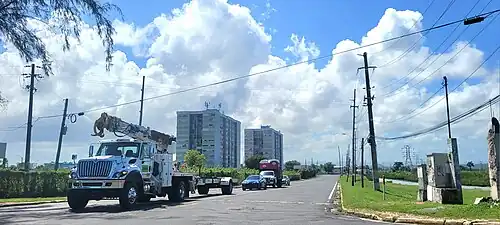 Northern terminus at PR-165 junction, looking south
Major intersections
 PR-22 east near exit 11 to PR-869 north between Bayamón and Cataño
.jpg.webp) PR-22 east at exit 11 to PR-5 and PR-869 north between Bayamón and Cataño
PR-22 east at exit 11 to PR-5 and PR-869 north between Bayamón and Cataño
| Municipality | Location | km[1] | mi | Destinations | Notes |
|---|---|---|---|---|---|
| Cataño | Palmas | 0.0 | 0.0 | Southern terminus of PR-869 | |
| Cataño–Bayamón municipal line | Palmas–Juan Sánchez line | 0.6– 0.7 | 0.37– 0.43 | PR-22 exits 11 and 13; diamond interchange | |
| Cataño | Palmas | 2.2 | 1.4 | ||
| 4.7 | 2.9 | Northern terminus of PR-869 | |||
| 1.000 mi = 1.609 km; 1.000 km = 0.621 mi | |||||
Related route
Highway 8869 | |
|---|---|
| Location | Cataño |
| Length | 2.6 km[5] (1.6 mi) |
Puerto Rico Highway 8869 (PR-8869) is a spur route located in Palmas barrio. It begins at PR-869 in Cucharillas community and ends at its junction with PR-5 near Puente Blanco community.[2] The entire route is located in Palmas, Cataño.
| km[5] | mi | Destinations | Notes | ||
|---|---|---|---|---|---|
| 0.0 | 0.0 | PR-869 | Western terminus of PR-8869; unsigned | ||
| 2.6 | 1.6 | Eastern terminus of PR-8869 | |||
| 1.000 mi = 1.609 km; 1.000 km = 0.621 mi | |||||
See also
References
- 1 2 Google (29 February 2020). "PR-869" (Map). Google Maps. Google. Retrieved 29 February 2020.
- 1 2 National Geographic Maps (2011). Puerto Rico (Map). 1:125,000. Adventure Map (Book 3107). Evergreen, Colorado: National Geographic Maps. ISBN 978-1566955188. OCLC 756511572.
- ↑ "Tránsito Promedio Diario (AADT)". Transit Data (Datos de Transito) (in Spanish). DTOP PR. p. 133. Archived from the original on 1 April 2019.
- ↑ "PR-869, Cataño, Puerto Rico". geoview.info. Retrieved 7 February 2020.
- 1 2 Google (29 February 2020). "PR-8869" (Map). Google Maps. Google. Retrieved 29 February 2020.
External links
 Media related to Puerto Rico Highway 869 at Wikimedia Commons
This article is issued from Wikipedia. The text is licensed under Creative Commons - Attribution - Sharealike. Additional terms may apply for the media files.