Puncak Jaya Regency
Kabupaten Puncak Jaya | |
|---|---|
 A view of the peak of Puncak Jaya, located in the southwestern portion of the regency | |
 Flag  Coat of arms | |
| Motto: Yabu Eeruwok | |
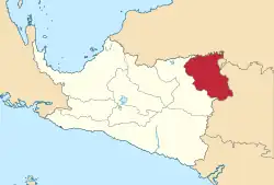 Location within Central Papua | |
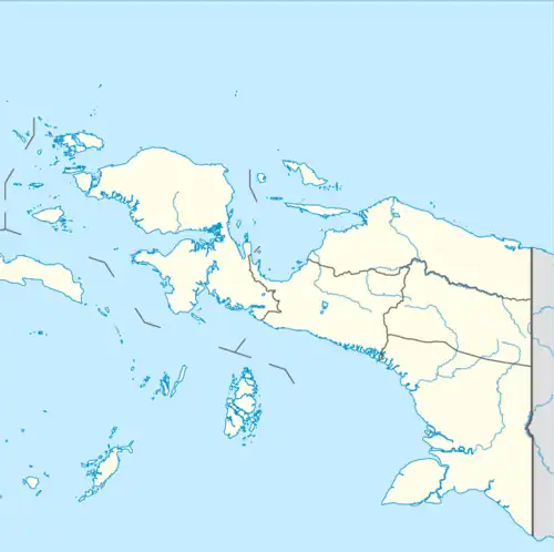 Puncak Jaya Regency Location in Indonesian Papua  Puncak Jaya Regency Location in Indonesia | |
| Coordinates: 3°42′00″S 137°57′53″E / 3.7001°S 137.9647°E | |
| Country | |
| Province | Central Papua |
| Capital | Mulia |
| Government | |
| • Regent | Yuni Wonda |
| • Vice Regent | Deinas Geley |
| Area | |
| • Total | 6,515 km2 (2,515 sq mi) |
| Population (mid 2022 estimate)[1] | |
| • Total | 231,499 |
| • Density | 36/km2 (92/sq mi) |
| Time zone | UTC+9 (IEST) |
| Area code | (+62) 901 |
| Website | puncakjayakab |
Puncak Jaya Regency is one of the regencies (kabupaten) in the Indonesian province of Central Papua. It is an inland highland regency,[2] lying directly east of Paniai Regency and west of Jayawijaya Regency and Tolikara Regency (including those new regencies which have subsequently been created within the former boundaries of those regencies).[3] As of 2004, it was reported that these four regencies had a population that is 93–97% ethnic Papua;[2] however this included areas which have subsequently been formed into new regencies.
In 2008 an additional regency - simply named Puncak Regency - was created from the western part of the area of Puncak Jaya Regency. The residual Puncak Jaya Regency covers an area of 6,515 km2, and had a population of 101,148 at the 2010 Census[4] which increased to 224,527 at the 2020 Census;[5] the official estimate as at mid 2022 was 231,499.[1]
The capital of the regency is Mulia.[6][7][8]
According to a 2009 profile in Indonesia's Tempo magazine, Puncak Jaya had sixteen districts (distrik) and 147 villages, and 147,000 residents;[9] however this did not take account of the fact that under the Law No. 7/2008, eight of these districts had already been removed from Puncak Jaya Regency in 2008 and formed into a separate Puncak Regency in 2008. The 2010 Census revealed a population of 101,148 in the residual Puncak Jaya Regency,[4] which by the 2020 Census had more than doubled to 224,527.[5] It is a difficult ten-hour drive from Wamena (Jayawijaya Regency) to the mostly undeveloped regency. Separatists in the Free Papua Movement are active in the area.[9]
Administrative districts
At the 2010 Census, the existing regency comprised eight districts (distrik), tabulated below with their populations at the 2010 Census.[4]
| Name of District (distrik) | Pop'n 2010 Census |
|---|---|
| Fawi | 3,420 |
| Mulia | 22,278 |
| Mewoluk | 5,189 |
| Yamo | 13,161 |
| Ilu | 18,344 |
| Torere | 6,710 |
| Jigonikme | 8,040 |
| Tingginambut | 24,006 |
However, by 2018 these had been split to create additional districts, which in 2018 numbered twenty-six, listed below with their areas and their populations at the 2020 Census.[5] The table also includes the locations of the district adminisrative centre, the number of administrative villages in each district (totaling 302 rural kampong and 3 urban kelurahan), and its post code. The nineteen new districts created by 2018 are Dagai, Dokome, Gubume, Gurage, Ilamburawi, Irimuli, Kalome, Kiyage, Lumo, Molanikime, Muara, Nioga, Nume, Pagaleme, Taganombak, Waegi, Wanwi, Yambi and Yamoneri; the previous Jigonikme District has ceased to exist.
| Kode Wilayah | Name of District (distrik) | Area in km2 | Pop'n Census 2020 | Admin Centre | No. of Villages | Post code |
|---|---|---|---|---|---|---|
| 94.02.03 | Fawi | 1,084 | 4,320 | Fawi | 9 | 98942 |
| 94.02.25 | Dagai | 481 | 4,033 | Dagai | 10 | 98941 |
| 94.02.26 | Kiyage | 200 | 5,179 | Kiyage | 8 | 98943 |
| 94.02.01 | Mulia | 154 | 32,755 | Wuyukwi | 11 (a) | 98915 |
| 94.02.14 | Yambi | 94 | 9,364 | Yambi | 9 | 98917 |
| 94.02.13 | Ilamburawi | 111 | 6,102 | Ilamburawi | 5 | 98912 |
| 94.02.12 | Muara | 76 | 11,319 | Muara | 8 | 98914 |
| 94.02.09 | Pagaleme | 160 | 12,212 | Pagaleme | 5 | 98916 |
| 94.02.10 | Gurage | 142 | 8,704 | Yarmukum | 11 | 98911 |
| 94.02.11 | Irimuli | 243 | 8,362 | Wondengobak | 9 | 98913 |
| 94.02.04 | Mewoluk | 275 | 8,594 | Mewoluk | 8 | 98945 |
| 94.02.15 | Lumo | 103 | 10,593 | Lumo | 9 | 98944 |
| 94.02.16 | Molanikime | 472 | 4,734 | Tiolome | 5 | 98946 |
| 94.02.05 | Yamo | 273 | 10,503 | Yamo | 14 | 98925 |
| 95.02.17 | Dokome | 228 | 5,103 | Dokome | 9 | 98924 |
| 94.02.02 | Ilu | 225 | 13,393 | Wurak | 21 (b) | |
| 94.02.20 | Yamoneri | 198 | 9,247 | Yamoneri | 16 | 98937 |
| 94.02.21 | Waegi | 130 | 10,349 | Anggutare | 19 | 98936 |
| 94.02.06 | Nume | 101 | 3,405 | Nume | 13 | 98933 |
| 94.02.22 | Nioga | 161 | 9,321 | Nioga | 11 | 98932 |
| 94.02.23 | Gubume | 90 | 5,793 | Gubume | 17 | 98931 |
| 94.02.24 | Taganombak | 645 | 4,737 | Guna | 10 | 98934 |
| 94.02.07 | Torere | 277 | 4,355 | Gubugani | 13 | 98926 |
| 94.02.08 | Tingginambut | 197 | 8,010 | Tingginambut | 22 | 98922 |
| 94.02.18 | Kalome | 197 | 8,119 | Kalome | 16 | 98921 |
| 94.02.19 | Wanwi | 198 | 5,921 | Wonwi | 17 | 98923 |
| Totals | 6,515 | 224,527 | 305 |
Notes: (a) includes two kelurahan - the towns of Wuyukwi and Pagaleme. (b) includes one kelurahan - the town of Wurak.
Towns included
- Aginilia
- Buguba
- Jebegot
- Lambo
- Mulia
- Mbambawa
- Motorbivak
- Rustoord
- Splitsingbivak
- Tombage
Climate
Mulia, the seat of the regency, has a subtropical highland climate (Köppen Cfb) with cool to pleasant mornings, warm to very warm afternoons, and heavy rainfall year-round.
| Climate data for Mulia | |||||||||||||
|---|---|---|---|---|---|---|---|---|---|---|---|---|---|
| Month | Jan | Feb | Mar | Apr | May | Jun | Jul | Aug | Sep | Oct | Nov | Dec | Year |
| Mean daily maximum °C (°F) | 24.3 (75.7) |
24.2 (75.6) |
23.9 (75.0) |
23.7 (74.7) |
23.3 (73.9) |
22.4 (72.3) |
21.7 (71.1) |
21.7 (71.1) |
22.6 (72.7) |
23.7 (74.7) |
24.1 (75.4) |
24.1 (75.4) |
23.3 (74.0) |
| Daily mean °C (°F) | 18.7 (65.7) |
18.7 (65.7) |
18.6 (65.5) |
18.5 (65.3) |
18.3 (64.9) |
17.7 (63.9) |
17.1 (62.8) |
17.1 (62.8) |
17.5 (63.5) |
18.2 (64.8) |
18.4 (65.1) |
18.6 (65.5) |
18.1 (64.6) |
| Mean daily minimum °C (°F) | 13.1 (55.6) |
13.2 (55.8) |
13.4 (56.1) |
13.4 (56.1) |
13.3 (55.9) |
13.1 (55.6) |
12.6 (54.7) |
12.5 (54.5) |
12.4 (54.3) |
12.7 (54.9) |
12.7 (54.9) |
13.2 (55.8) |
13.0 (55.4) |
| Average rainfall mm (inches) | 260 (10.2) |
288 (11.3) |
293 (11.5) |
262 (10.3) |
230 (9.1) |
215 (8.5) |
219 (8.6) |
222 (8.7) |
220 (8.7) |
238 (9.4) |
215 (8.5) |
228 (9.0) |
2,890 (113.8) |
| Source: Climate-Data.org[10] | |||||||||||||
References
- 1 2 Badan Pusat Statistik, Jakarta, 2023, Kabupaten Puncak Jaya Dalam Angka 2023 (Katalog-BPS 1102001.9402)
- 1 2 McGibbon, Rodd. Plural Society in Peril: Migration, Economic Change, and the Papua Conflict, East–West Center (2004). Retrieved December 20, 2010.
- ↑ Map of Papua Province, Indonesia, East–West Center publication. Retrieved December 20, 2010.
- 1 2 3 Biro Pusat Statistik, Jakarta, 2011.
- 1 2 3 Badan Pusat Statistik, Jakarta, 2021.
- ↑ "Archived copy" (PDF). Archived from the original (PDF) on 2017-12-29. Retrieved 2010-12-20.
{{cite web}}: CS1 maint: archived copy as title (link) - ↑ "TWIN OTTER SKIDS AT MULIA AIRPORT, PAPUA. – ANT – LKBN ANTARA (Indonesia) | HighBeam Research". Highbeam.com. 2006-02-14. Retrieved 2010-12-21.
- ↑ Country Reports on Human Rights ... – Google Books. September 2008. Retrieved 2010-12-21.
- 1 2 (16 March 2009). Building a New Papua,Tempo. Retrieved December 20, 2010.
- ↑ "Climate: Mulia". Climate-Data.org. Retrieved 26 November 2020.
External links
- Detail maps from Indonesian government, this regency:[1] (includes northern portion) [2] (includes southern portion, including location of Mulia)
- Statistics publications from Statistics Indonesia (BPS)
Regencies and cities of Central Papua | ||
|---|---|---|
Capital: Nabire | ||
| Regencies | ||
- ↑ "Archived copy" (PDF). Archived from the original (PDF) on 2011-01-11. Retrieved 2010-12-20.
{{cite web}}: CS1 maint: archived copy as title (link) - ↑ "Archived copy" (PDF). Archived from the original (PDF) on 2011-07-21. Retrieved 2010-12-20.
{{cite web}}: CS1 maint: archived copy as title (link)