| Quarles Range | |
|---|---|
 | |
| Geography | |
| Continent | Antarctica |
| Region | Ross Dependency |
| Range coordinates | (85°36′S 164°30′W / 85.600°S 164.500°W |
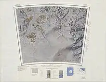
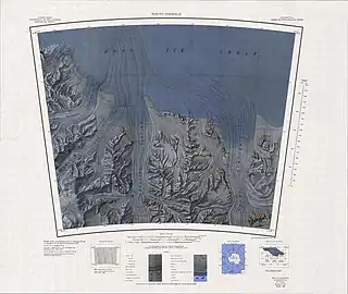
Quarles Range (85°36′S 164°30′W / 85.600°S 164.500°W) is a high and rugged range of the Queen Maud Mountains, extending from the polar plateau between Cooper Glacier and Bowman Glacier and terminating near the edge of Ross Ice Shelf.[1]
Discovery and naming
Peaks in the range were first sighted by Captain Roald Amundsen in 1911, and the range was mapped in detail by the Byrd Antarctic Expedition, 1928–30. It was named by the Advisory Committee on Antarctic Names (US-ACAN) for Donald A. Quarles, United States Secretary of the Air Force, 1955–57, and United States Deputy Secretary of Defense, 1957–59, at the outset of the International Geophysical Year and organization of United States activity in Antarctica.[1]
Location
The west of the Quarles Range is north of the head of the Bowman Glacier, which in turn is north of Rawson Plateau. The Mohn Basin lies to the southwest. Mount Wedel-Jarlsburg rises above the head of the Cooper Glacier to the north.[2] Further east, the range extends between Cooper Glacier, a tributary of Axel Heiberg Glacier to the north, and Bowman Glacier, another tributary of Axel Heiberg Glacier to the southeast. Peaks from west to east include Mount Ruth Gade, Mount Harrington, Mount Balecz, Mount Dean and Schobert Nunatak.[3] Rawson Plateau includes Mount Hanssen in the south, the Thomas Spur extending between Tate Glacier and Moffett Glacier to the east, Mount Deardorff, Mount Alice Gade and Mount Maloney.[3]
Features
Mount Wedel-Jarlsberg
85°39′S 165°08′W / 85.650°S 165.133°W. An ice-covered mountain between Cooper and Bowman Glaciers, standing 2 nautical miles (3.7 km; 2.3 mi) southwest of Mount Ruth Gade in the Quarles Range. Discovered in December 1911 by Roald Amundsen, and named by him for Alice Wedel-Jarlsberg, wife of a Norwegian diplomat.[4]
Mount Ruth Gade
85°37′S 164°40′W / 85.617°S 164.667°W. A pyramidal mountain, 3,515 metres (11,532 ft) high, standing 3 nautical miles (5.6 km; 3.5 mi) northeast of Mount Wedel-Jarlsberg in the Quarles Range. Discovered in November 1911 by Capt. Roald Amundsen, and named by him for one of the daughters of the Norwegian minister to Brazil, a strong supporter of Amundsen.[5]
Mount Harrington
85°34′S 164°00′W / 85.567°S 164.000°W. A mountain, 2,550 metres (8,370 ft) high, standing 4 nautical miles (7.4 km; 4.6 mi) northeast of Mount Ruth Gade in the Quarles Range. Mapped by the Byrd Antarctic Expedition, 1928-30, and by the United States Geological Survey (USGS) from surveys and United States Navy air photos, 1960-64. Named by thw United States Advisory Committee on Antarctic Names (US-ACAN) for John R. Harrington, meteorologist with the South Pole Station winter party, 1962.[6]
Mount Belecz
85°34′S 163°27′W / 85.567°S 163.450°W. An ice-covered, flat-topped mountain, 2,120 metres (6,960 ft) high, standing 6 nautical miles (11 km; 6.9 mi) northeast of Mount Ruth Gade in the Quarles Range. First mapped from ground surveys and air photos by the Byrd Antarctic Expedition, 1928-30. Named by US-ACAN for Dan M. Belecz, meteorologist with the South Pole Station winter party in 1962.[7]
Mount Dean
85°32′S 163°00′W / 85.533°S 163.000°W. A mountain, 1,620 metres (5,310 ft) high, standing at the northeast end of the Quarles Range, 2 nautical miles (3.7 km; 2.3 mi) northeast of Mount Belecz. Probably first seen by Roald Amundsen's polar party in 1911. First mapped by the Byrd Antarctic Expedition, 1928-30. Named by US-ACAN for Jesse D. Dean, meteorologist with the South Pole Station party of 1962.[8]
Schobert Nunatak
85°31′S 162°14′W / 85.517°S 162.233°W. A nunatak overlooking the terminus of Bowman Glacier, standing 4 nautical miles (7.4 km; 4.6 mi) east of Mount Dean, at the northeast end of Quarles Range. First mapped by the Byrd Antarctic Expedition, 1928-30. Named by US-ACAN for William J. Schobert, aviation electrician and maintenance shop supervisor with United States Navy Squadron VX-6 for several Deep Freeze operations, 1964-67 period.[9]
Rawson Plateau
85°52′S 164°45′W / 85.867°S 164.750°W. An ice-covered plateau, 15 nautical miles (28 km; 17 mi) long and 3,400 metres (11,200 ft) high, rising between the heads of the Bowman, Moffett and Steagall Glaciers. Mapped by the Byrd Antarctic Expedition, 1928-30, and by the USGS from surveys and United States Navy air photos, 1960-64. Named for Kennett L. Rawson, a contributor to the Byrd Antarctic Expedition, 1928-30, and a member of the Byrd Antarctic Expedition, 1933-35.[10]
Features include:
Mount Hanssen
85°59′S 164°28′W / 85.983°S 164.467°W. An ice-covered mountain distinguished by a sharp peak, 3,280 metres (10,760 ft) high, standing at the southernmost point of Rawson Plateau. Discovered by Capt. Roald Amundsen while enroute to the South Pole in November 1911, and named by him for Helmer Hanssen, deputy leader of the South Pole Party.[11]
Thomas Spur
85°53′S 161°40′W / 85.883°S 161.667°W. A prominent spur extending eastward from Rawson Plateau between Moffett and Tate Glaciers. Mapped by USGS from surveys and United States Navy air photos, 1960-64. Named by US-ACAN for Harry F. Thomas, meteorologist, South Pole Station winter party, 1960.[12]
Mount Deardorff
85°48′S 162°34′W / 85.800°S 162.567°W. Prominent peak, 2,380 metres (7,810 ft) high, surmounting the massive ridge dividing the heads of Moffett and Steagall Glaciers. First mapped from ground surveys and air photos by the Byrd Antarctic Expedition, 1928-30. Named by US-ACAN for J. Evan Deardorff who made cosmic ray studies at McMurdo Station in 1964.[8]
Mount Alice Gade
85°45′S 163°40′W / 85.750°S 163.667°W. A mainly ice-covered mountain over 3,400 metres (11,200 ft) high, marking the northeast extremity of the Rawson Plateau. Discovered in November 1911 by Captain Roald Amundsen, and named by him for one of the daughters of the Norwegian minister to Brazil, a strong supporter of Amundsen.[13]
Mount Maloney
85°41′S 163°35′W / 85.683°S 163.583°W. A mountain, 1,990 metres (6,530 ft) high, standing 4 nautical miles (7.4 km; 4.6 mi) north of Mount Alice Gade at the southeast side of Bowman Glacier. Discovered and mapped by the Byrd Antarctic Expedition, 1928-30. Named by US-ACAN for John H. Maloney, Jr., meteorologist with the South Pole Station winter party, 1960.[14]
References
- 1 2 Alberts 1995, p. 598.
- ↑ Liv Glacier USGS.
- 1 2 Mount Goodale USGS.
- ↑ Alberts 1995, p. 801.
- ↑ Alberts 1995, p. 639.
- ↑ Alberts 1995, p. 314.
- ↑ Alberts 1995, p. 56.
- 1 2 Alberts 1995, p. 178.
- ↑ Alberts 1995, p. 654.
- ↑ Alberts 1995, p. 606.
- ↑ Alberts 1995, p. 311.
- ↑ Alberts 1995, pp. 742–743.
- ↑ Alberts 1995, p. 12.
- ↑ Alberts 1995, p. 458.
Sources
- Alberts, Fred G., ed. (1995), Geographic Names of the Antarctic (PDF) (2 ed.), United States Board on Geographic Names, retrieved 2023-12-03
 This article incorporates public domain material from websites or documents of the United States Board on Geographic Names.
 - Liv Glacier, USGS: United States Geological Survey, retrieved 2024-01-04
- Mount Goodale, USGS: United States Geological Survey, retrieved 2024-01-04
![]() This article incorporates public domain material from websites or documents of the United States Geological Survey.
This article incorporates public domain material from websites or documents of the United States Geological Survey.