Quarry Township | |
|---|---|
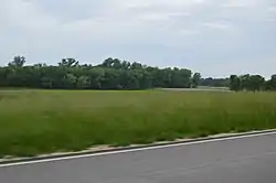 Fields west of Grafton | |
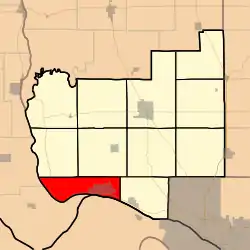 Location in Jersey County | |
 Jersey County's location in Illinois | |
| Coordinates: 38°59′08″N 90°28′34″W / 38.98556°N 90.47611°W | |
| Country | United States |
| State | Illinois |
| County | Jersey |
| Established | November 5, 1878 |
| Area | |
| • Total | 23.14 sq mi (59.9 km2) |
| • Land | 20.42 sq mi (52.9 km2) |
| • Water | 2.72 sq mi (7.0 km2) 11.75% |
| Elevation | 794 ft (242 m) |
| Population (2010) | |
| • Estimate (2016)[1] | 1,111 |
| • Density | 57.5/sq mi (22.2/km2) |
| Time zone | UTC-6 (CST) |
| • Summer (DST) | UTC-5 (CDT) |
| ZIP codes | 62028, 62031, 62037 |
| FIPS code | 17-083-62354 |
Quarry Township is one of eleven townships in Jersey County, Illinois, United States. As of the 2010 census, its population was 1,174 and it contained 610 housing units.[2]
History
The name of Quarry Township was changed from Grafton Township on April 1, 1880.
Geography
According to the 2010 census, the township has a total area of 23.14 square miles (59.9 km2), of which 20.42 square miles (52.9 km2) (or 88.25%) is land and 2.72 square miles (7.0 km2) (or 11.75%) is water.[2]
Cities, towns, villages
Adjacent townships
- Otter Creek Township (northeast)
- Elsah Township (east)
- Rosedale Township (northwest)
Cemeteries
The township contains these two cemeteries: Hartford and Scenic Hill.
Major highways
Airports and landing strips
- Department of Corrections heliport
Rivers
Lakes
- Gilbert Lake
- Lower Stump Lake
Landmarks
Demographics
| Census | Pop. | Note | %± |
|---|---|---|---|
| 2016 (est.) | 1,111 | [1] | |
| U.S. Decennial Census[3] | |||
School districts
Political districts
- Illinois' 17th congressional district
- State House District 97
- State Senate District 49
References
- "Quarry Township, Jersey County, Illinois". Geographic Names Information System. United States Geological Survey, United States Department of the Interior. Retrieved January 17, 2010.
- United States Census Bureau 2007 TIGER/Line Shapefiles
- United States National Atlas
- 1 2 "Population and Housing Unit Estimates". Retrieved June 9, 2017.
- 1 2 "Population, Housing Units, Area, and Density: 2010 - County -- County Subdivision and Place -- 2010 Census Summary File 1". United States Census. Archived from the original on February 12, 2020. Retrieved May 28, 2013.
- ↑ "Census of Population and Housing". Census.gov. Retrieved June 4, 2016.
External links
Municipalities and communities of Jersey County, Illinois, United States | ||
|---|---|---|
| Cities | Map of Illinois highlighting Jersey County | |
| Town | ||
| Villages | ||
| Townships | ||
| Unincorporated communities | ||
| Footnotes | ‡ This populated place also has portions in an adjacent county or counties | |
This article is issued from Wikipedia. The text is licensed under Creative Commons - Attribution - Sharealike. Additional terms may apply for the media files.