RAF Madley | |||||||||||||||||||
|---|---|---|---|---|---|---|---|---|---|---|---|---|---|---|---|---|---|---|---|
Apr2006.jpg.webp) Madley Communications Centre earth satellite tracking station | |||||||||||||||||||
| Summary | |||||||||||||||||||
| Airport type | Military | ||||||||||||||||||
| Operator | Royal Air Force | ||||||||||||||||||
| Location | Madley | ||||||||||||||||||
| Elevation AMSL | 265 ft / 81 m | ||||||||||||||||||
| Coordinates | 52°01′55″N 002°50′56″W / 52.03194°N 2.84889°W | ||||||||||||||||||
| Map | |||||||||||||||||||
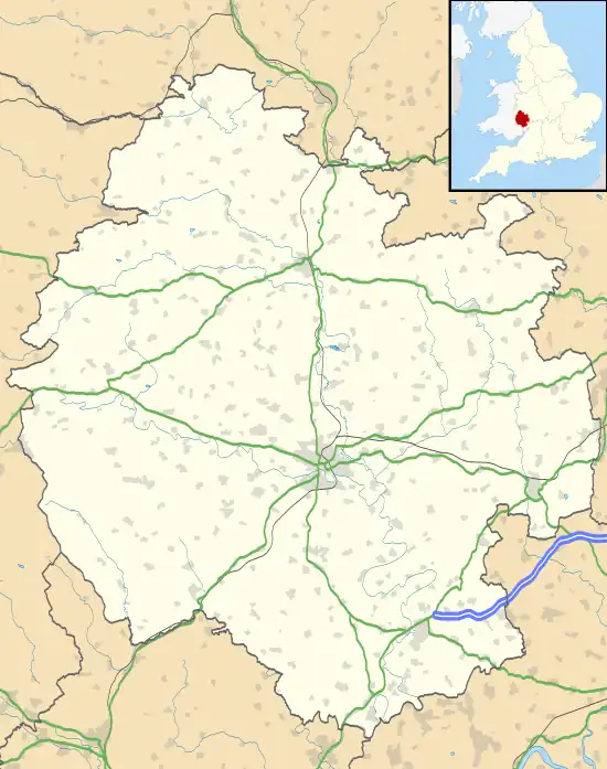
 RAF Madley Location in Herefordshire | |||||||||||||||||||
| Runways | |||||||||||||||||||
| |||||||||||||||||||
Royal Air Force Madley, or more simply RAF Madley, was a Royal Air Force station situated 6.2 miles (10 km) south west of Hereford in Herefordshire, England.[1] The station was in use during the Second World War as a training base and was located between the villages of Kingstone and Madley.
History
The site opened as a training centre for aircrew and ground wireless operators on 27 August 1941.[2] In 1941, No. 4 Signals School RAF was stated up at the base. The school was disbanded and renamed as No. 4 Radio School RAF in January 1943.[3]
In 1943, the grass airfield was reinforced with Sommerfeld Tracking and the centre's population rose to about 5,000.[4] Also in 1943, RAF Madley became a base for one of ten Royal Air Force Mountain Rescue Teams (MRT) that had been set up to rescue lost aircrew.[5] The site was visited in 1944 prior to D-Day by US General George S. Patton, and later by Rudolf Hess (who had been held prisoner near Abergavenny) on his way to the Nuremberg Trials in 1946.[6]
The station was not bombed by the Luftwaffe, however, as with other bases, crashes of friendly aircraft were commonplace. On Christmas Day 1944, a Liberator crashed in the station environs which precipitated the usual search for the crew.[2] This had proved fruitless as the crew had baled out over Belgium as they assumed the heavily flak-damaged aircraft was about to crash. However, the aircraft somehow made it all the way to Madley without its aircrew.[7]
The comedian and actor Eric Sykes was a radio operator at RAF Madley during the Second World War.[8]
Units posted here
- No. 4 Radio School (January 1943 - December 1946)
- No. 4 Signals School (August 1941 - January 1943)
- No. 8 Anti-Aircraft Co-operation Unit RAF (July 1941 – 1943)
- No. 25 Maintenance Unit (April 1952 - March 1954)
- No. 26 Squadron RAF detachment during 1942 using the North American Mustang I
- No. 50 Gliding School RAF(January 1946– January 1947)[9]
Current use
Today only a few hangars remain, and Madley Communications Centre now occupies part of the site.[10] Other parts of the site have been converted into a wildlife wetlands centre that is used for study.[11] The B4352 and an unclassified road now cut what was the airfield area in two.[2][1]
See also
References
- 1 2 "189" (Map). Hereford & Ross-on-Wye. 1:25,000. Explorer. Ordnance Survey. 2015. ISBN 978-0-319-24382-4.
- 1 2 3 McLelland 2012, p. 151.
- ↑ Lake, Alan (1999). Flying units of the RAF : the ancestry, formation and disbandment of all flying units from 1912. Shrewsbury: Airlife. p. 186. ISBN 1-84037-086-6.
- ↑ "History of RAF Madley". www.mesc.org.uk. Retrieved 11 February 2017.
- ↑ Card, Frank (2001). "Squadron Leader G D Graham DSO MBE". Journal of the Royal Air Force Historical Society (24): 50. ISSN 1361-4231.
- ↑ Historic England. "Madely[sic] Airfield (1402537)". Research records (formerly PastScape). Retrieved 12 February 2017.
- ↑ Smith, David J. (1981). Military airfields of Wales and the North-West (1 ed.). Cambridge: P. Stephens. p. 121. ISBN 0-85059-485-5.
- ↑ "The vision of gliders high above brings back so many memories". Evesham Journal. 1 October 2009. Retrieved 11 February 2017.
- ↑ "Madley - Airfields of Britain Conservation Trust UK". www.abct.org.uk. Retrieved 11 February 2017.
- ↑ "RAF Madley (No 4 Radio School), airfield, Madley". Historic Herefordshire Online. Retrieved 11 February 2017.
- ↑ "About us". www.mesc.org.uk. Retrieved 11 February 2017.
Bibliography
- McLelland, Tim (2012). Action stations revisited volume 5. Manchester, UK: Crecy. ISBN 978-0-85979-111-3.