| RAF Warmwell USAAF Station AAF-454 RAF Moreton  | |||||||||||
|---|---|---|---|---|---|---|---|---|---|---|---|
| Warmwell, Dorset in England | |||||||||||
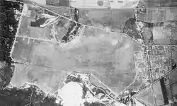 Aerial Photo of Warmwell Airfield - 16 August 1943 | |||||||||||
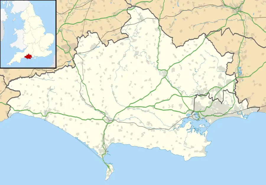 RAF Warmwell Shown within Dorset | |||||||||||
| Coordinates | 50°41′50″N 002°20′40″W / 50.69722°N 2.34444°W | ||||||||||
| Type | Royal Air Force Satellite Station | ||||||||||
| Code | XW | ||||||||||
| Site information | |||||||||||
| Owner | Air Ministry | ||||||||||
| Operator | Royal Air Force United States Army Air Forces | ||||||||||
| Controlled by | RAF Flying Training Command 1937-40 RAF Fighter Command 1940-44 & 1944- Ninth Air Force 1944 | ||||||||||
| Site history | |||||||||||
| Built | 1936/37 | ||||||||||
| In use | May 1937 - November 1945 | ||||||||||
| Battles/wars | European theatre of World War II | ||||||||||
| Airfield information | |||||||||||
| Elevation | 63 metres (207 ft)[1] AMSL | ||||||||||
| |||||||||||
Royal Air Force Warmwell or more simply RAF Warmwell is a former Royal Air Force station near Warmwell in Dorset, England from 1937 to 1946, located about 5 miles east-southeast of Dorchester; 100 miles southwest of London.
During the Second World War it was used by the Royal Air Force and the United States Army Air Forces Ninth Air Force.
History
RAF use
At 206 feet (63 m) above sea level RAF Warmwell originally opened in May 1937 as a landing ground named RAF Woodsford, for units carrying out air-to-ground firing and bombing on ranges set up off the south coast of Dorset at Chesil Bank. With the airfield code of 'XW' it was renamed RAF Warmwell in July 1938 due to possible confusion with Woodford, near Manchester, which was an airfield where Avro was producing the Lancaster bomber. After the use by squadrons using the ranges diminished, and as the Second World War started more and more units were based here to act as fighter defence for the important naval facilities at Portland and Portsmouth, as well as working in 10 Group as part of the fighter defences for the south-west of England. Warmwell's three runways remained grass-surfaced for its entire life even though as the war progressed, and the emphasis became on intruding into German-occupied Europe, many intruder units were based here, using the Supermarine Spitfire, Hawker Hurricane and Tempest, and the Westland Whirlwind, the first twin-engined heavy fighter for the RAF.
- Air Sea Rescue Flight RAF, Warmwell (1941) became No. 276 Squadron RAF [2]
The following units were also here at some point:[3]
- No. 2 Squadron RAF
- No. 3 Squadron RAF
- No. 13 Squadron RAF
- No. 19 Squadron RAF
- No. 26 Squadron RAF
- No. 41 Squadron RAF
- No. 56 Squadron RAF
- No. 63 Squadron RAF
- No. 66 Squadron RAF
- No. 79 Squadron RAF
- No. 80 Squadron RAF
- No. 118 Squadron RAF
- No. 130 Squadron RAF
- No. 137 Squadron RAF
- No. 152 Squadron RAF
- No. 164 Squadron RAF
- No. 174 Squadron RAF
- No. 175 Squadron RAF
- No. 181 Squadron RAF
- No. 182 Squadron RAF
- No. 184 Squadron RAF
- No. 217 Squadron RAF
- No. 225 Squadron RAF
- No. 234 Squadron RAF
- No. 238 Squadron RAF
- No. 245 Squadron RAF
- No. 247 Squadron RAF
- No. 257 Squadron RAF
- No. 263 Squadron RAF
- No. 266 Squadron RAF
- No. 274 Squadron RAF
- No. 275 Squadron RAF
- No. 276 Squadron RAF
- No. 277 Squadron RAF
- No. 286 Squadron RAF
- No. 302 Polish Fighter Squadron
- No. 310 Squadron RAF
- No. 312 (Czechoslovak) Squadron RAF
- No. 313 Squadron RAF
- No. 340 Squadron RAF
- No. 350 (Belgian) Squadron RAF
- No. 401 Squadron RCAF
- No. 402 Squadron RCAF
- No. 403 Squadron RCAF
- No. 411 Squadron RCAF
- No. 412 Squadron RCAF
- No. 414 Squadron RCAF
- No. 416 Squadron RCAF
- No. 421 Squadron RCAF
- No. 430 Squadron RCAF
- No. 438 Squadron RCAF
- No. 439 Squadron RCAF
- No. 440 Squadron RCAF
- No. 442 Squadron RCAF
- No. 443 Squadron RCAF
- No. 500 Squadron RAF
- No. 501 Squadron RAF
- No. 604 Squadron RAF
- No. 609 Squadron RAF
- No. 610 Squadron RAF
- 793 Naval Air Squadron
- 794 Naval Air Squadron
- 810 Naval Air Squadron
- 814 Naval Air Squadron
- Units
- No. 2 Air Observers School RAF
- No. 6 Armament Training Camp RAF
- No. 6 Armament Training Station RAF
- No. 6 Fighter Command Servicing Unit
- No. 6 Flying Training School RAF
- No. 6 Service Flying Training School RAF
- No. 8 Anti-Aircraft Co-operation Unit RAF
- No. 9 Service Flying Training School RAF
- No. 10 Air Observers School RAF
- No. 10 Bombing and Gunnery School RAF
- No. 10 Group Target Towing Flight RAF
- No. 14 Armament Practice Camp RAF
- No. 17 Armament Practice Camp RAF
- No. 1487 (Fighter) Gunnery Flight RAF
- No. 1487 (Target Towing) Flight RAF
- No. 2714 Squadron RAF Regiment
- No. 2768 Squadron RAF Regiment
- No. 2772 Squadron RAF Regiment
- No. 2824 Squadron RAF Regiment
- No. 2954 Squadron RAF Regiment
- Central Gunnery School RAF
USAAF use
Although USAAF-marked aircraft were seen at Warmwell from July 1942 it was not until March 1944 that the base came under American control. While under USAAF control, Warmwell was known as USAAF Station AAF-454 for security reasons, and by which it was referred to instead of location.
474th Fighter Group
The 474th Fighter Group arrived on 12 March 1944 from Oxnard Flight Strip California[4] flying Lockheed P-38 "Lightnings". Operational squadrons of the group were:
- 428th Fighter Squadron (F5)
- 429th Fighter Squadron (7Y)
- 430th Fighter Squadron (K6)
Resumed RAF use
The 474th was a group of Ninth Air Force's 70th Fighter Wing, IX Tactical Air Command which left for the Continent in August 1944, and the RAF once more assumed control of the airfield. After the last RAF squadrons to be based there left and Armament Practice Camps stopped using the ranges by October 1945 the station went onto Care and Maintenance the following month before closing down. During the immediate post-war years the hangars were used for food storage but this was not quite the end for the airfield, for during the extensive test programme for the Westland Wyvern, company test pilot Harald Penrose had to make a force-landing on the obstructed and overgrown surface.
Current use
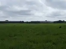
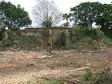
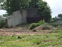
The airfield proper has for many years been occupied by a quarry which has effectively removed all trace of the flying field, whilst the site on which the technical site once lay is now a small village called Crossways, the original northern taxiway being still in use as a road through the village where two dispersal pans and the old ATC tower (albeit heavily converted to a public dwelling - Egdon House) still remain, and the old station cinema is now the village hall. The two bellman style hangars still remain, rumoured to be used by local farmers for fertilizer storage, plus an Over Blister hangar (one of eight built during the war) and other buildings exist in the woodland areas surrounding Crossways, although some have been demolished. One of the base's billets is now one of the local shops, and at the junction of Mount Skippet Way and Airfield Close in Crossways village housing is a memorial to the airfield, located in a grassed recreational area. During recent clearance work in preparation for new buildings on the North East side of the old airfield a brick block house and a concrete rifle range were revealed. Both have now been demolished but the photographs shown were taken just prior to their removal. Further clearances to build an access road across the south-east corner of the flying field has also resulted in the excavation of a group of the aircraft tie-down points.
See also
References
![]() This article incorporates public domain material from the Air Force Historical Research Agency
This article incorporates public domain material from the Air Force Historical Research Agency
Citations
- ↑ Falconer 1998, p. 87.
- ↑ Lake 1999, p. 22.
- ↑ "Warmwell (Woodsford)". Airfields of Britain Conservation Trust. Retrieved 30 April 2022.
- ↑ Maurer 1980, p. 347.
Bibliography
- Falconer, J (1998). RAF Fighter Airfields of World War 2. UK: Ian Allan Publishing. ISBN 0-7110-2175-9.
- Freeman, Roger A. (1994) UK Airfields of the Ninth: Then and Now 1994. After the Battle ISBN 0-900913-80-0
- Freeman, Roger A. (1996) The Ninth Air Force in Colour: UK and the Continent-World War Two. After the Battle ISBN 1-85409-272-3
- Lake, A (1999). Flying units of the RAF. Shrewsbury: Airlife. ISBN 1-84037-086-6.
- Maurer, M. Air Force Combat Units Of World War II. USAF Historical Division. Washington D.C., USA: Zenger Publishing Co., Inc, 1980. ISBN 0-89201-092-4.
- USAAS-USAAC-USAAF-USAF Aircraft Serial Numbers--1908 to present
- Anthony Cooke (2000) Reflections of RAF Warmwell: ISBN 0-9539052-0-9
- Anthony Cooke (1995) Airfield Focus - 21: Warmwell . ISBN 1 870384 42 3
.svg.png.webp)