Rasulpur Kulian | |
|---|---|
Village | |
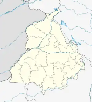 Rasulpur Kulian Location in Punjab, India  Rasulpur Kulian Rasulpur Kulian (India) | |
| Coordinates: 31°18′21″N 75°25′06″E / 31.305822°N 75.418449°E | |
| Country | |
| State | Punjab |
| District | Kapurthala |
| Government | |
| • Type | Panchayati raj (India) |
| • Body | Gram panchayat |
| Population (2011) | |
| • Total | 18 |
| Sex ratio 9/9♂/♀ | |
| Languages | |
| • Official | Punjabi |
| • Other spoken | Hindi |
| Time zone | UTC+5:30 (IST) |
| PIN | 144601 |
| Telephone code | 01822 |
| ISO 3166 code | IN-PB |
| Vehicle registration | PB-09 |
| Website | kapurthala |
Rasulpur Kulian is a village in Kapurthala district of Punjab State, India. It is located 7.5 kilometres (4.7 mi) from Kapurthala, which is both district and sub-district headquarters of Rasulpur Kulian. The village is administrated by a Sarpanch, who is an elected representative.
Demography
According to the report published by Census India in 2011, Rasulpur Kulian has 2 houses with the total population of 18 persons of which 9 are male and 9 females. Literacy rate of Rasulpur Kulian is 80.00%, higher than the state average of 75.84%. The population of children in the age group 0–6 years is 3 which is 16.67% of the total population. Child sex ratio is approximately 500, lower than the state average of 846.[1]
Population data
| Particulars | Total | Male | Female |
|---|---|---|---|
| Total No. of Houses | 2 | - | - |
| Population | 18 | 9 | 9 |
| Child (0-6) | 3 | 2 | 1 |
| Schedule Caste | 0 | 0 | 0 |
| Schedule Tribe | 0 | 0 | 0 |
| Literacy | 80.00 % | 85.71 % | 75.00 % |
| Total Workers | 6 | 6 | 0 |
| Main Worker | 6 | 0 | 0 |
| Marginal Worker | 0 | 0 | 0 |
References
- ↑ "Rasulpur Kulian". Retrieved 26 July 2016.
External links
This article is issued from Wikipedia. The text is licensed under Creative Commons - Attribution - Sharealike. Additional terms may apply for the media files.