Raucourt-et-Flaba | |
|---|---|
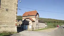 Train station | |
 Coat of arms | |
Location of Raucourt-et-Flaba | |
 Raucourt-et-Flaba  Raucourt-et-Flaba | |
| Coordinates: 49°36′11″N 4°57′29″E / 49.6031°N 4.9581°E | |
| Country | France |
| Region | Grand Est |
| Department | Ardennes |
| Arrondissement | Sedan |
| Canton | Vouziers |
| Government | |
| • Mayor (2020–2026) | Véronique Duru[1] |
| Area 1 | 21.83 km2 (8.43 sq mi) |
| Population | 817 |
| • Density | 37/km2 (97/sq mi) |
| Time zone | UTC+01:00 (CET) |
| • Summer (DST) | UTC+02:00 (CEST) |
| INSEE/Postal code | 08354 /08450 |
| Elevation | 177–320 m (581–1,050 ft) (avg. 180 m or 590 ft) |
| 1 French Land Register data, which excludes lakes, ponds, glaciers > 1 km2 (0.386 sq mi or 247 acres) and river estuaries. | |
Raucourt-et-Flaba (French pronunciation: [ʁokuʁ e flaba]) is a commune in the Ardennes department in northern France.
Population
| Year | Pop. | ±% |
|---|---|---|
| 1962 | 1,092 | — |
| 1968 | 1,196 | +9.5% |
| 1975 | 1,102 | −7.9% |
| 1982 | 973 | −11.7% |
| 1990 | 923 | −5.1% |
| 1999 | 906 | −1.8% |
| 2008 | 869 | −4.1% |
See also
References
- ↑ "Répertoire national des élus: les maires". data.gouv.fr, Plateforme ouverte des données publiques françaises (in French). 2 December 2020.
- ↑ "Populations légales 2021". The National Institute of Statistics and Economic Studies. 28 December 2023.
Wikimedia Commons has media related to Raucourt-et-Flaba.
This article is issued from Wikipedia. The text is licensed under Creative Commons - Attribution - Sharealike. Additional terms may apply for the media files.