Religara
Pachhiari | |
|---|---|
Census Town | |
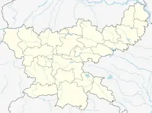
 Religara Location in Jharkhand, India  Religara Religara (India) | |
| Coordinates: 23°41′21″N 85°22′13″E / 23.68917°N 85.37026°E | |
| Country | |
| State | Jharkhand |
| District | Hazaribagh |
| Population (2011) | |
| • Total | 8,239 |
| Languages (*For language details see Dadi (community development block)#Language and religion) | |
| • Official | Hindi, Urdu |
| Time zone | UTC+5:30 (IST) |
| PIN | 829129 (Religara) |
| Telephone/ STD code | 06545 |
| Vehicle registration | JH 02 |
| Website | hazaribag |
Religara, also called Pachhiari, is a census town in the Dadi CD block in the Hazaribagh Sadar subdivision of the Hazaribagh district in the Indian state of Jharkhand.
Geography
Some census towns and locations around Hazaribagh city have been shown in the Hazaribagh City map
M: municipality, CT: census town, R: rural/ urban centre, T: tourist centre, D: dam, HS: hot spring
Owing to space constraints in the small map, the actual locations in a larger map may vary slightly
Location
Religara is located at 23°41′21″N 85°22′13″E / 23.68917°N 85.37026°E.
Area overview
Hazaribagh district is a plateau area and forests occupy around about 45% of the total area. It is a predominantly rural area with 92.34% of the population living in rural areas against 7.66% in the urban areas. There are many census towns in the district, as can be seen in the map alongside. Agriculture is the main occupation of the people but with the extension of coal mines, particularly in the southern part of the district, employment in coal mines is increasing. However, it has to be borne in mind that modern mining operations are highly mechanised. Four operational areas of Central Coalfields are marked on the map. All these areas are spread across partly this district and partly the neighbouring districts.[1][2][3]
Note: The map alongside presents some of the notable locations in the district. All places marked in the map are linked in the larger full screen map. Urbanisation data calculated on the basis of census data for CD blocks and may vary a little against unpublished official data.
Demographics
According to the 2011 Census of India, Religara had a total population of 8,239, of which 4,270 (52%) were males and 3,969 (48%) were females. Population in the age range 0–6 years was 996. The total number of literate persons in Religara was 5,547 (76.58% of the population over 6 years).[4]
As of 2001 India census,[5] Religara alias Pachhiari had a population of 7,470. Males constitute 53% of the population and females 47%. Religara alias Pachhiari has an average literacy rate of 61%, higher than the national average of 59.5%: male literacy is 69%, and female literacy is 51%. In Religara alias Pachhiari, 14% of the population is under 6 years of age.
Infrastructure
According to the District Census Handbook 2011, Hazaribagh, Religara covered an area of 3.33 km2. Among the civic amenities, it had 13 km roads with open drains, the protected water supply involved uncovered well, tapwater from untreated sources and service reservoir. It had 1,563 domestic electric connections, 186 road lighting points. Among the educational facilities it had 5 primary schools, 2 middle schools, 2 secondary schools, 1 senior secondary school. The nearest general degree college at Ramgarh, 33 km away. Among the social, recreational and cultural facilities, it had 1 stadium, 1 auditorium/ community hall. Three important commodities it manufactured were gate/ grill, furniture, soil item. It had the branch offices of 1 nationalised bank, 1 agricultural credit society, 1 non-agricultural credit society.[6]
Economy
Projects in the Argada Area of Central Coalfields are: Gidi A O/C, Gidi C O/C, Religara O/C, U/G, Sirka O/C, Sirka U/G, Argada UG and Gidi Washery.[7]
Transport
Patratu railway station, on the Barkakana-Son Nagar line, serves this area. Religara is easily accessible by local buses and taxis from Patratu. The nearest airport is Ranchi Airport.
References
- ↑ "District Census Handbook, Hazaribag, 2011, Series 21, Part XII A" (PDF). Pages 11-14. Directorate of Census Operations, Jharkhand. Retrieved 1 November 2017.
- ↑ "District Census Handbook, Hazaribagh, 2011, Series 21, Part XII B" (PDF). Census of India 2011 Page 26. Directorate of Census Operations, Jharkhand. Retrieved 26 January 2021.
- ↑ "The North Karanpura Coalfields". Jharkhand. sinclair-environmental. Archived from the original on 16 May 2015. Retrieved 15 January 2021.
- ↑ "2011 Census C.D. Block Wise Primary Census Abstract Data(PCA)". Jharkhand – District-wise CD Blocks. Registrar General and Census Commissioner, India. Retrieved 11 November 2017.
- ↑ "Census of India 2001: Data from the 2001 Census, including cities, villages and towns (Provisional)". Census Commission of India. Archived from the original on 16 June 2004. Retrieved 1 November 2008.
- ↑ "District Census Handbook Hazaribagh, Census of India 2011, Series 20, Part XII A" (PDF). Pages 651-662. Directorate of census Operations, Jharkhand. Retrieved 21 January 2021.
- ↑ "Central Coalfields Limited". Areas - Argada. CCL. Retrieved 11 November 2017.
