Richelieu | |
|---|---|
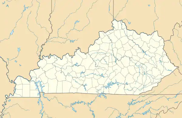 Richelieu Location within the state of Kentucky | |
| Coordinates: 37°0′16.53″N 86°41′30.27″W / 37.0045917°N 86.6917417°W | |
| Country | United States |
| State | Kentucky |
| County | Logan |
| Elevation | 597 ft (182 m) |
| Time zone | UTC-6 (Central (CST)) |
| • Summer (DST) | UTC-5 (CST) |
| ZIP codes | 42271 |
| Area code(s) | 270 and 364 |
| GNIS feature ID | 508934[1] |
Richelieu is an unincorporated community in Logan County, Kentucky, United States.[1]
Geography
Richelieu is located near Logan County's northeastern boundary with Butler County along Kentucky Route 1038. It is also located near the tripoint where Logan and Butler County boundaries meet with those of Warren County.[2]
References
- 1 2 U.S. Geological Survey Geographic Names Information System: Richelieu, Kentucky
- ↑ DeLorme (2010). Kentucky Atlas and Gazetteer (Map). Yarmouth, Maine: DeLorme. p. 63. § H10. ISBN 0-89933-340-0.
Municipalities and communities of Logan County, Kentucky, United States | ||
|---|---|---|
| Cities | 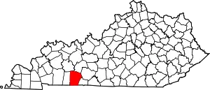 Location of Logan County, Kentucky | |
| CDP | ||
| Other unincorporated communities | ||
| Footnotes | ‡This populated place also has portions in an adjacent county or counties | |
Municipalities and communities of Butler County, Kentucky, United States | ||
|---|---|---|
| Cities |  Location of Butler County, Kentucky | |
| Unincorporated communities | ||
| Footnotes | ‡This populated place also has portions in an adjacent county or counties | |
This article is issued from Wikipedia. The text is licensed under Creative Commons - Attribution - Sharealike. Additional terms may apply for the media files.