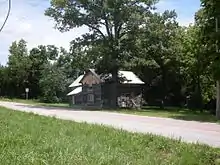
The old Richville store on Route W
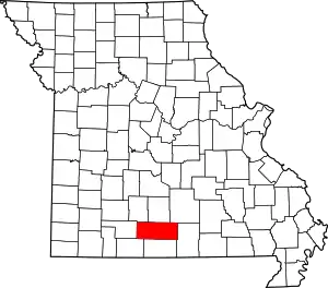
Richville is an unincorporated community in southeastern Douglas County, Missouri, United States.[1] Richville is located at the intersection of Missouri State Route 14 and State route W and a short distance west of the intersection of Route 14 and Missouri State Route 181. The site is located on a high ridge at an elevation of 1,191 ft (363 m).[1] Sauls Knob at 1,339 ft (408 m)[2] lies just to the southeast on the south side of Route 14.[3]
History
A post office called Richville was established in 1870, and remained in operation until 1933.[4] The community was named after the local Rich family.[5]
References
- 1 2 U.S. Geological Survey Geographic Names Information System: Richville, Douglas County, Missouri
- ↑ Feature Detail Report for: Sauls Knob
- ↑ Missouri Atlas & Gazetteer, DeLorme, 1998, First edition, p. 64, ISBN 0-89933-224-2
- ↑ "Post Offices". Jim Forte Postal History. Retrieved September 28, 2016.
- ↑ "Douglas County Place Names, 1928–1945 (archived)". The State Historical Society of Missouri. Archived from the original on June 24, 2016. Retrieved September 28, 2016.
{{cite web}}: CS1 maint: bot: original URL status unknown (link)
36°50′25″N 92°14′22″W / 36.84028°N 92.23944°W
This article is issued from Wikipedia. The text is licensed under Creative Commons - Attribution - Sharealike. Additional terms may apply for the media files.
