Rilawala | |
|---|---|
 Rilawala Grama Niladhari Division | |
| Coordinates: 6°47′24″N 79°58′42″E / 6.790069°N 79.978388°E | |
| Country | Sri Lanka |
| Province | Western Province |
| District | Colombo District |
| Divisional Secretariat | Homagama Divisional Secretariat |
| Electoral District | Colombo Electoral District |
| Polling Division | Homagama Polling Division |
| Area | |
| • Total | 1.07 km2 (0.41 sq mi) |
| Elevation | 10 m (30 ft) |
| Population (2012)[2] | |
| • Total | 1,695 |
| • Density | 1,584/km2 (4,100/sq mi) |
| ISO 3166 code | LK-1112335 |
Rilawala Grama Niladhari Division is a Grama Niladhari Division of the Homagama Divisional Secretariat of Colombo District of Western Province, Sri Lanka . It has Grama Niladhari Division Code 593A.
Polgasowita and Kahathuduwa are located within, nearby or associated with Rilawala.
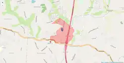
Rilawala is a surrounded by the Kahathuduwa West, Kirigampamunuwa, Siyambalagoda South, Wethara, Undurugoda and Siyambalagoda North Grama Niladhari Divisions.
Demographics
Ethnicity
The Rilawala Grama Niladhari Division has a Sinhalese majority (99.4%) . In comparison, the Homagama Divisional Secretariat (which contains the Rilawala Grama Niladhari Division) has a Sinhalese majority (98.1%) [2]
Religion
The Rilawala Grama Niladhari Division has a Buddhist majority (98.4%) . In comparison, the Homagama Divisional Secretariat (which contains the Rilawala Grama Niladhari Division) has a Buddhist majority (96.2%) [2]
Places adjacent to Rilawala Grama Niladhari Division | ||||||||||||||||
|---|---|---|---|---|---|---|---|---|---|---|---|---|---|---|---|---|
| ||||||||||||||||
References
- ↑ "USGS EarthExplorer". earthexplorer.usgs.gov. U.S. Geological Survey. 2020.
- 1 2 3 4 5 "Census of Population and Housing 2012". statistics.gov.lk. Department of Census and Statistics, Sri Lanka. 2012.