| Ritzlihorn | |
|---|---|
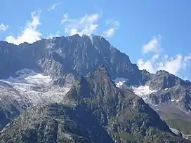 Ritzlihorn seen from Gelmersee (in the foreground is the Stampfhoren) | |
| Highest point | |
| Elevation | 3,282 m (10,768 ft)[1] |
| Prominence | 329 m (1,079 ft)[2] |
| Parent peak | Finsteraarhorn |
| Isolation | 5.84 km (3.63 mi) |
| Listing | Alpine mountains above 3000 m |
| Coordinates | 46°38′0.5″N 8°15′31.4″E / 46.633472°N 8.258722°E |
| Geography | |
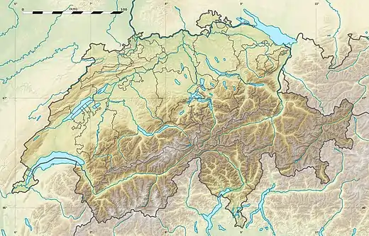 Ritzlihorn Location in Switzerland | |
| Location | Bern, Switzerland |
| Parent range | Bernese Alps |
| Climbing | |
| First ascent | 1816 by Johann Jakob Frey [3] |
The Ritzlihorn (3,282 m) is a mountain of the Bernese Alps, overlooking Handegg in the canton of Bern. It lies on the range east of the Gauli Glacier and north of the Bächlistock.
References
- ↑ Retrieved from the Swisstopo topographic maps and Google Earth.
- ↑ "Ritzlihorn - Peakvisor". peakvisor.com. Retrieved 24 May 2020.
- ↑ Paul Caminada, Pioniere der Alpentopographie: die Geschichte der Schweizer Kartenkunst, AS Verlag, 2003. Page 179
External links
Wikimedia Commons has media related to Ritzlihorn.
This article is issued from Wikipedia. The text is licensed under Creative Commons - Attribution - Sharealike. Additional terms may apply for the media files.