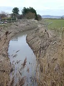
The River Gele (Welsh: Afon Gele) is a river in the North Wales and a tributary of the River Clwyd. The town of Abergele takes its name from the river. The spelling is a dialectal spelling of the Welsh word gelau (spear or blade).[1] The river gives its name to an electoral ward, called Gele, which includes the southern half of Abergele town.
The river used to empty into the sea direct through the town of Abergele, but the Rhuddlan Marsh embankment act of 1794, diverted the river from the south of the town in an eastwards direction across the south of Rhuddlan Marsh and into the River Clwyd at Towyn.[2][3] A short distance of the rivermouth is tidal.[4]
In 2010 and 2011 there were pollution scares on the river near its meeting point with the River Clwyd at Kinmel Bay.[5] The river has also subjected the area to flooding, with the worst recorded event in 1971. This has led to a culverting of some areas and banks being installed on the floodplain to the east and south of Abergele.[6]
References
- ↑ Mills, David (2011). A dictionary of British place-names. Oxford: Oxford University Press. p. 2. ISBN 978-0-19-960908-6.
- ↑ Plant, Steve (2014). A wander around the coast of Wales : a 870-mile walk following the coastal path of Wales from north to south. Peterborough: Fastprint. p. 21. ISBN 978-178035-761-4.
- ↑ Owen, Hywel Wyn (2015). The place-names of Wales. Cardiff: University of Wales. p. 4. ISBN 978-1-78316-164-5.
- ↑ "264" (Map). Vale of Clwyd. 1:25,000. Explorer. Ordnance Survey. 2015. ISBN 9780319244616.
- ↑ Hughes, Ian (8 September 2011). "River Gele pollution headache for Council". North Wales Weekly News. Retrieved 9 April 2013.
- ↑ "Flood schemes protect two towns". BBC News. 9 March 2011. Retrieved 6 March 2020.
External links
53°17′40″N 3°32′05″W / 53.2944°N 3.5347°W