| Rouillon | |
|---|---|
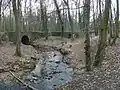
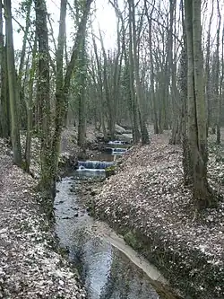 Rouillon river near Longjumeau | |
  | |
| Location | |
| Country | France |
| Physical characteristics | |
| Source | |
| • coordinates | 48°40′47″N 2°12′42″E / 48.67972°N 2.21167°E |
| Mouth | |
• location | Yvette |
• coordinates | 48°41′6″N 2°19′11″E / 48.68500°N 2.31972°E |
| Length | 9.5 km (5.9 mi) |
| Basin features | |
| Progression | Yvette→ Orge→ Seine→ English Channel |
The Rouillon is a small river in southern Île-de-France (France), left tributary of the Yvette, which is a tributary of the Orge. Its source is in Villejust, north of Longjumeau, in the Essonne department. It is 9.5 km (5.9 mi) long.[1]
The Rouillon crosses the following départements and towns:
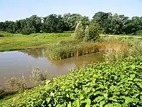
Rouillon river near Villejust
Tributaries
- le ruisseau blanc
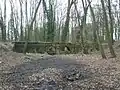
Special places
A bridge, call le pont des Templiers (templars bridge), considering as the older bridge in Essonne department, is nearby Balizy, an area of Longjumeau. It was built in the 13th century.
References
Wikimedia Commons has media related to Rouillon River.
This article is issued from Wikipedia. The text is licensed under Creative Commons - Attribution - Sharealike. Additional terms may apply for the media files.