 | |
|---|---|
| Route nationale 1 | |
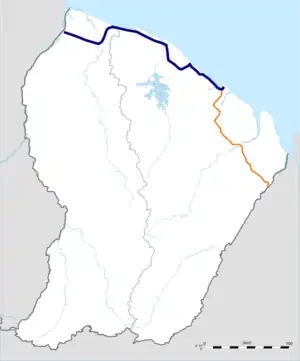
 Route national 1 in blue | |
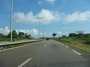
 Route nationale 1 near Cayenne | |
| Route information | |
| Length | 258 km (160 mi) |
| Major junctions | |
| West end | Cayenne |
| |
| East end | |
| Location | |
| Country | France |
| Overseas region | French Guiana |
| Department | Guyane |
| Highway system | |
Route nationale 1 (RN1) is a highway in French Guiana, an overseas region and department of France in South America. The highway connects Cayenne with Saint-Laurent-du-Maroni and measures 258 kilometres (160 mi).[1] The highway is the busiest road of French Guiana.[2]
Overview
In 1863, road construction started on Route Coloniale 1 to connect Cayenne with Saint-Laurent-du-Maroni. The road was built by prisoners of the penal colony. Many prisoners died during the construction.[3] In 1970s, the section connecting Kourou with Sinnamary was rerouted for the construction of the Guiana Space Centre.[4] In 1999, the road between Balata and Maringouins was widened to a 2x2 lanes dual carriageway.[5] In 2014, a grade-separated intersection with Route nationale 2 to Saint-Georges was opened.[6] The busiest section is in Cayenne where 44,543 vehicles per day used the road in 2010.[2]
Route
The highways begins in Cayenne. In Balata, Matoury, there is an intersection with Route National 2.[6] The road continues to Kourou, makes a detour around the Guiana Space Centre, and continues to Sinnamary, Iracoubo, and finally ends in Saint-Laurent-du-Maroni.[4] In Saint-Laurent-du-Maroni there is a ferry to Albina, Suriname.[7]
Future plans
There are plans for a bridge connecting Saint-Laurent-du-Maroni with Albina. The bridge was on the agenda in a ministerial meeting between France and Suriname in November 2020.[8] An interesting part about the bridge is that Suriname uses left-hand drive while French Guiana uses right-hand drive.[9]
References
- ↑ "Entretien courant de chaussée sur la RN1 et RN2". NouMa (in French). Retrieved 19 March 2021.
- 1 2 Ministère de l'Écologie, du Développement durable, des Transports et du Logement (2010). "La sécurité routière en Guyane" (PDF) (in French). Retrieved 19 March 2021.
{{cite web}}: CS1 maint: multiple names: authors list (link) - ↑ "Miam-miam aux îles du Salut". Atelier de Creation Libertaire (in French). Retrieved 19 March 2021.
- 1 2 "Le réseau routier national de la Guyane". DEAL Guyane (in French). Retrieved 19 March 2021.
- ↑ "Loi de finances pour 2001 - Section 2c". National Assembly of France (in French). Retrieved 19 March 2021.
- 1 2 "L'échangeur de Balata ouvert et inauguré aujourd'hui". France Guyane (in French). Retrieved 19 March 2021.
- ↑ "Transport". Ministry of Transport, Suriname (in Dutch). Retrieved 19 March 2021.
- ↑ "'Er komt ook een brug over de Marowijnerivier tussen Suriname en Frans-Guyana'". Waterkant (in Dutch). Retrieved 19 March 2021.
- ↑ "Compilation of Foreign Motor Vehicle Import Requirements" (PDF). United States Department of Commerce International Trade Administration Office of Transportation and Machinery. December 2015. Retrieved 19 March 2021.
External links
 Media related to Route nationale 1 (French Guiana) at Wikimedia Commons