| Route nationale 2 | |
|---|---|
| Major junctions | |
| from end | Antananarivo |
| to Toamasina | |
| Location | |
| Country | Madagascar |
| Highway system | |

Route nationale 2 near Beforona
Route nationale 2 (RN2) is a primary highway in Madagascar. The route runs from the capital city of Antananarivo to Toamasina, a city on the eastern coast of the Madagascar.
The twisting route is served by taxi-brousses and buses.[1]
Selected locations on route (from west to east)
- Antananarivo
- Ambohimangakely
- Sambaina
- Ambanitsena
- Manjakandriana (48 km from Antananarivo)
- Mangoro River Bridge
- Moramanga (junction with RN 44)
- Analamazoatra Reserve and Andasibe-Mantadia National Park
- Beforona
- Ranomafana Est
- Antsampanana (junction with RN 11)
- Brickaville
- Rianila River Bridge
- Toamasina
Gallery
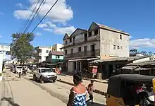
.jpg.webp) the capital of Antananarivo
the capital of Antananarivo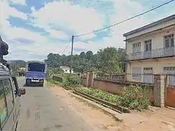
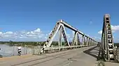 Bridge over Rianila river near Brickaville
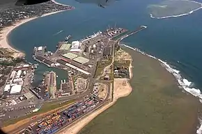 port of Toamasina (Tamatave)
See also
References
Wikimedia Commons has media related to Route nationale 2 (Madagascar).
- ↑ Lonely Planet Madagascar & Comoros, p. 190 (2008)
This article is issued from Wikipedia. The text is licensed under Creative Commons - Attribution - Sharealike. Additional terms may apply for the media files.