Ruhlsdorf | |
|---|---|
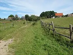
 Landscape in south of Ruhlsdorf | |
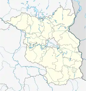
Location of Ruhlsdorf | |
 Ruhlsdorf  Ruhlsdorf | |
| Coordinates: 52°34′10″N 13°59′36″E / 52.56944°N 13.99333°E | |
| Country | Germany |
| State | Brandenburg |
| District | Märkisch-Oderland |
| Municipality | Strausberg |
| Elevation | 94 m (308 ft) |
| Population (2007-12-31) | |
| • Total | 44 |
| Time zone | UTC+01:00 (CET) |
| • Summer (DST) | UTC+02:00 (CEST) |
| Postal codes | 15344 |
| Dialling codes | 03341 |
| Vehicle registration | MOL |
Ruhlsdorf is a village and a civil parish (Ortsteil) of the German town of Strausberg, located in the district of Märkisch-Oderland in Brandenburg. With a population of 44 (as of 2007),[1] it is the littlest one of its municipality.
Geography
The village is situated at the eastern borders of its municipality, close to Hohenstein and in the territory of the Märkische Schweiz Nature Park. It is crossed by a road linking Strausberg and Buckow and, in south of the inhabited area, it lies a little lake named Ruhlsdorfer See.
Tourism
Ruhlsdorf is a receptive place for tourism due to its natural environment and to its position in a nature park.
See also
References
- ↑ (in German) Infos about the population of the village Archived 2010-06-02 at the Wayback Machine
External links
Wikimedia Commons has media related to Ruhlsdorf.
This article is issued from Wikipedia. The text is licensed under Creative Commons - Attribution - Sharealike. Additional terms may apply for the media files.