| Rural City of Benalla Victoria | |||||||||||||||
|---|---|---|---|---|---|---|---|---|---|---|---|---|---|---|---|
 Location in Victoria | |||||||||||||||
| Population | 14,528 (2021 census)[1] | ||||||||||||||
| • Density | 6.1742/km2 (15.991/sq mi) | ||||||||||||||
| Established | 2002 | ||||||||||||||
| Gazetted | 17 October 2002[2] | ||||||||||||||
| Area | 2,353 km2 (908.5 sq mi)[1] | ||||||||||||||
| Mayor | Cr Danny Claridge | ||||||||||||||
| Council seat | Benalla | ||||||||||||||
| Region | Hume | ||||||||||||||
| State electorate(s) | Euroa | ||||||||||||||
| Federal division(s) | Indi | ||||||||||||||
| Website | Rural City of Benalla | ||||||||||||||
| |||||||||||||||
The Rural City of Benalla is a local government area in the Hume region of Victoria, Australia, located in the north-east part of the state. It covers an area of 2,353 square kilometres (908 sq mi) and, in August 2021, had a population of 14,528.[1]
It includes the towns of Baddaginnie, Benalla, Devenish, Goorambat, Major Plains, Swanpool, Tatong, Thoona, Warrenbayne and Winton. It was formed in 2002 from the de-amalgamation of the Shire of Delatite into the current rural city and the Shire of Mansfield,[2] the former being a merger between the latter, the Shire of Benalla and the City of Benalla.
The Rural City is governed and administered by the Benalla Rural City Council; its seat of local government and administrative centre is located at the council headquarters in Benalla. The Rural City is named after the main urban settlement located in the centre-north of the LGA, that is Benalla, which is also the LGA's most populous urban centre with a population of 10,331.[3]
Council
Current composition
The council is composed of seven councillors elected to represent an unsubdivided municipality.[4]
| Ward | Councillor | Notes | |
|---|---|---|---|
| Unsubdivided | Justin King | ||
| Danny Claridge | |||
| Peter Davis | |||
| Don Firth | |||
| Bernie Hearn | |||
| Gail O'Brien | |||
| Punarji Hewa Gunaratne | |||
Administration and governance
The council meets in the council chambers at the council headquarters in the Benalla Municipal Offices, which is also the location of the council's administrative activities. It also provides customer services at its administrative centre in Benalla.
Townships and localities
The 2021 census, the rural city had a population of 14,528 up from 13,861 in the 2016 census[5]
| Population | ||
|---|---|---|
| Locality | 2016 | 2021 |
| Archerton | 17 | 16 |
| Baddaginnie^ | 338 | 347 |
| Benalla | 10,330 | 10,822 |
| Boho South^ | 77 | 93 |
| Boweya^ | 41 | 51 |
| Boxwood^ | 20 | 19 |
| Bridge Creek^ | 97 | 117 |
| Broken Creek | 39 | 45 |
| Bungeet | 31 | 29 |
| Bungeet West | 45 | 44 |
| Chesney Vale | 157 | 204 |
| Creek Junction^ | 16 | 34 |
| Devenish | 197 | 208 |
| Glenrowan^ | 963 | 1,049 |
| Glenrowan West | 62 | 75 |
| Goomalibee | 83 | 91 |
| Goorambat | 297 | 269 |
| Lima | 79 | 92 |
| Lima East | 151 | 165 |
| Population | ||
|---|---|---|
| Locality | 2016 | 2021 |
| Lima South | 99 | 142 |
| Lurg | 225 | 220 |
| Major Plains^ | 37 | 36 |
| Molyullah | 131 | 160 |
| Moorngag | 96 | 75 |
| Mount Bruno | 54 | 47 |
| Samaria | 57 | 57 |
| Stewarton^ | 116 | 118 |
| Swanpool | 207 | 227 |
| Taminick | 103 | 139 |
| Tarnook | 89 | 103 |
| Tatong | 287 | 281 |
| Thoona | 127 | 133 |
| Upper Lurg | 121 | 107 |
| Upper Ryans Creek | 39 | 40 |
| Warrenbayne | 145 | 144 |
| Winton | 108 | 103 |
| Winton North | 7 | 8 |
^ - Territory divided with another LGA
See also
References
- 1 2 3 Australian Bureau of Statistics (28 June 2022). "Benalla (Local Government Area)". 2021 Census QuickStats. Retrieved 17 November 2023.
- 1 2 Victoria Government Gazette – Online Search (17 October 2002). "G42 of 2002: Order estg the Rural City of Benalla and Shire of Mansfield" (PDF). Victoria Government Gazette. State Government of Victoria. pp. 85–97. Retrieved 10 January 2014.
- ↑ Census QuickStats (2011). "Benalla (SS) – SSC20115". Australian Bureau of Statistics. Government of Australia. Retrieved 10 January 2014.
- ↑ Local Government in Victoria. "Benalla Rural City Council". Department of Transport, Planning and Local Infrastructure. State Government of Victoria. Retrieved 10 January 2014.
- ↑ "Census | Australian Bureau of Statistics". www.abs.gov.au. 11 January 2023.
External links
- Benalla Rural City Council official website
- Metlink local public transport map
- Link to Land Victoria interactive maps
36°33′00″S 145°58′00″E / 36.55000°S 145.96667°E
Localities in the Rural City of Benalla | ||
|---|---|---|
| City | 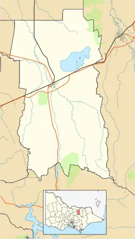 | |
| Town | ||
| Locality |
| |
^ - Territory divided with another LGA | ||