| Russell West Glacier | |
|---|---|
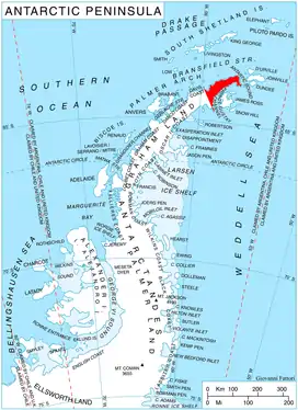 Location of Trinity Peninsula in the Antarctic Peninsula | |
 Location of Russell West in Antarctica | |
| Location | Trinity Peninsula |
| Coordinates | 63°40′S 58°50′W / 63.667°S 58.833°W |
| Length | 11 nmi (20 km; 13 mi) |
| Width | 4 nmi (7 km; 5 mi) |
| Thickness | unknown |
| Terminus | Prince Gustav Channel |
| Status | unknown |
Russell West Glacier (63°40′S 58°50′W / 63.667°S 58.833°W) is a glacier, 11 nautical miles (20 km) long and 4 nautical miles (7 km) wide, which lies immediately north of Detroit Plateau and flows from Mount Canicula, Verdikal Gap and Trajan Gate westward into Bone Bay on the north side of Trinity Peninsula. This glacier together with Russell East Glacier, which flows eastward into Prince Gustav Channel on the south side of Trinity Peninsula, form a through glacier across the north part of Antarctic Peninsula. It was first surveyed in 1946 by the Falkland Islands Dependencies Survey (FIDS). Named by the United Kingdom Antarctic Place-Names Committee (UK-APC) for V.I. Russell, surveyor and leader of the FIDS base at Hope Bay in 1946.
See also
Map
- Trinity Peninsula. Scale 1:250000 topographic map. Institut für Angewandte Geodäsie and British Antarctic Survey, 1996.
References
 This article incorporates public domain material from "Russell West Glacier". Geographic Names Information System. United States Geological Survey.
This article is issued from Wikipedia. The text is licensed under Creative Commons - Attribution - Sharealike. Additional terms may apply for the media files.