Rutledge Township | |
|---|---|
 Location in DeWitt County | |
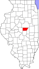 DeWitt County's location in Illinois | |
| Coordinates: 40°15′32″N 88°45′34″W / 40.25889°N 88.75944°W | |
| Country | |
| State | |
| County | DeWitt |
| Established | November 2, 1858 |
| Area | |
| • Total | 24.49 sq mi (63.4 km2) |
| • Land | 24.47 sq mi (63.4 km2) |
| • Water | 0.02 sq mi (0.05 km2) 0.08% |
| Elevation | 755 ft (230 m) |
| Population (2020) | |
| • Total | 136 |
| • Density | 5.6/sq mi (2.1/km2) |
| Time zone | UTC-6 (CST) |
| • Summer (DST) | UTC-5 (CDT) |
| ZIP codes | 61735, 61752, 61842 |
| FIPS code | 17-039-66469 |
| GNIS feature ID | 429689 |
Rutledge Township is one of thirteen townships in DeWitt County, Illinois, USA. As of the 2020 census, its population was 136 and it contained 63 housing units.[2] Rutledge Township changed its name from Douglas Township on June 7, 1859.
Geography
According to the 2021 census gazetteer files, Rutledge Township has a total area of 24.49 square miles (63.43 km2), of which 24.47 square miles (63.38 km2) (or 99.92%) is land and 0.02 square miles (0.05 km2) (or 0.08%) is water.[3]
Cemeteries
The township contains the Johnson Cemetery.
Demographics
As of the 2020 census[2] there were 136 people, 8 households, and 8 families residing in the township. The population density was 5.55 inhabitants per square mile (2.14/km2). There were 63 housing units at an average density of 2.57 per square mile (0.99/km2). The racial makeup of the township was 97.79% White, 0.00% African American, 0.00% Native American, 0.74% Asian, 0.00% Pacific Islander, 0.00% from other races, and 1.47% from two or more races. Hispanic or Latino of any race were 2.21% of the population.
There were 8 households, out of which none had children under the age of 18 living with them and 100.00% were married couples living together. The average household size was 2.13 and the average family size was 2.13.
The township's age distribution consisted of 100.0% who were 65 years of age or older. For every 100 females, there were 88.9 males. For every 100 females age 18 and over, there were 88.9 males.
School districts
- Blue Ridge Community Unit School District 18
- Clinton Community Unit School District 15
- Le Roy Community Unit School District 2
| Census | Pop. | Note | %± |
|---|---|---|---|
| 1930 | 432 | — | |
| 1940 | 344 | −20.4% | |
| 1950 | 285 | −17.2% | |
| 1960 | 307 | 7.7% | |
| 1970 | 229 | −25.4% | |
| 1980 | 229 | 0.0% | |
| 1990 | 189 | −17.5% | |
| 2000 | 201 | 6.3% | |
| 2010 | 177 | −11.9% | |
| 2020 | 136 | −23.2% |
Political districts
- Illinois's 15th congressional district
- State House District 87
- State Senate District 44
References
- "Rutledge Township, DeWitt County, Illinois". Geographic Names Information System. United States Geological Survey, United States Department of the Interior. Retrieved July 6, 2010.
- United States Census Bureau 2009 TIGER/Line Shapefiles
- United States National Atlas
- ↑ U.S. Geological Survey Geographic Names Information System: Rutledge Township, DeWitt County, Illinois
- 1 2 "Explore Census Data". data.census.gov. Retrieved January 22, 2023.
- ↑ Bureau, US Census. "Gazetteer Files". Census.gov. Retrieved January 22, 2023.
External links
Places adjacent to Rutledge Township, DeWitt County, Illinois | |
|---|---|
Municipalities and communities of DeWitt County, Illinois, United States | ||
|---|---|---|
| Cities | Map of Illinois highlighting DeWitt County | |
| Villages | ||
| Townships | ||
| CDP | ||
| Other communities | ||
| Footnotes | ‡This populated place also has portions in an adjacent county or counties | |