Saint-Éloi | |
|---|---|
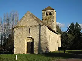 The church of Saint-Symphorien-Chaluzy | |
Location of Saint-Éloi | |
 Saint-Éloi  Saint-Éloi | |
| Coordinates: 46°58′29″N 3°13′19″E / 46.9747°N 3.2219°E | |
| Country | France |
| Region | Bourgogne-Franche-Comté |
| Department | Nièvre |
| Arrondissement | Nevers |
| Canton | Nevers-2 |
| Intercommunality | Loire et Allier |
| Government | |
| • Mayor (2020–2026) | Jérôme Malus[1] |
| Area 1 | 16.45 km2 (6.35 sq mi) |
| Population | 2,218 |
| • Density | 130/km2 (350/sq mi) |
| Time zone | UTC+01:00 (CET) |
| • Summer (DST) | UTC+02:00 (CEST) |
| INSEE/Postal code | 58238 /58000 |
| Elevation | 171–244 m (561–801 ft) |
| 1 French Land Register data, which excludes lakes, ponds, glaciers > 1 km2 (0.386 sq mi or 247 acres) and river estuaries. | |
Saint-Éloi (French pronunciation: [sɛ̃.t‿elwa]) is a commune in the Nièvre department, central France.[3]
Population
| Year | Pop. | ±% p.a. |
|---|---|---|
| 1968 | 946 | — |
| 1975 | 1,000 | +0.80% |
| 1982 | 1,484 | +5.80% |
| 1990 | 1,805 | +2.48% |
| 1999 | 1,904 | +0.60% |
| 2007 | 1,969 | +0.42% |
| 2012 | 2,146 | +1.74% |
| 2017 | 2,146 | +0.00% |
| Source: INSEE[4] | ||
See also
References
- ↑ "Répertoire national des élus: les maires". data.gouv.fr, Plateforme ouverte des données publiques françaises (in French). 2 December 2020.
- ↑ "Populations légales 2021". The National Institute of Statistics and Economic Studies. 28 December 2023.
- ↑ INSEE commune file
- ↑ Population en historique depuis 1968, INSEE
Wikimedia Commons has media related to Saint-Éloi (Nièvre).
This article is issued from Wikipedia. The text is licensed under Creative Commons - Attribution - Sharealike. Additional terms may apply for the media files.