Saint-Étienne-de-Beauharnois | |
|---|---|
 | |
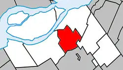
 Location within Beauharnois-Salaberry RCM | |
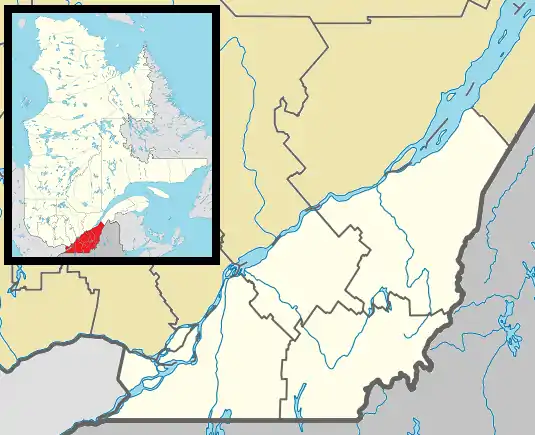
 St-Étienne-de-Beauharnois Location in southern Quebec | |
| Coordinates: 45°15′N 73°55′W / 45.25°N 73.92°W[1] | |
| Country | Canada |
| Province | Quebec |
| Region | Montérégie |
| RCM | Beauharnois-Salaberry |
| Constituted | January 1, 1867 |
| Government | |
| • Mayor | Martin Dumaresq |
| • Federal riding | Salaberry—Suroît |
| • Prov. riding | Beauharnois |
| Area | |
| • Total | 41.44 km2 (16.00 sq mi) |
| • Land | 40.63 km2 (15.69 sq mi) |
| Population (2021)[4] | |
| • Total | 1,099 |
| • Density | 27.1/km2 (70/sq mi) |
| • Pop (2016-21) | |
| • Dwellings | 431 |
| Time zone | UTC−5 (EST) |
| • Summer (DST) | UTC−4 (EDT) |
| Postal code(s) | |
| Area code(s) | 450 and 579 |
| Highways | |
| Website | www |
Saint-Étienne-de-Beauharnois is a municipality of Quebec, Canada, located within the Beauharnois-Salaberry Regional County Municipality in the Montérégie administrative region. The population as of the Canada 2021 Census was 1,099.
The town is located on the banks of the Saint-Louis River.
History
Settlement began in the early 19th century. In 1831, its first mill was built. In 1852, residents of the Saint-Clément and Saint-Louis parishes petitioned the Archbishop of Montreal for the creation of a new parish, which was granted after land was offered in the new settlement for a church. It construction began in 1863 and completed a year later.[5]
Its post office opened in 1865, and 2 years later, on January 1, 1867, the municipality was established out of territory from Saint-Clément (since 1957 part of Beauharnois) and Saint-Louis-de-Gonzague. It was named after Saint Stephen and Beauharnois County in which it is located. On October 26, 1869, it changed statutes and became the Parish Municipality of Saint-Etienne. This reverted back to Municipality of Saint-Étienne-de-Beauharnois on March 15, 1969.[1][6]
Demographics
Population
| 2021 | 2016 | 2011 | |
|---|---|---|---|
| Population | 1,099 (+32.3% from 2016) | 831 (+3.1% from 2011) | 806 (+4.1% from 2006) |
| Land area | 40.63 km2 (15.69 sq mi) | 40.79 km2 (15.75 sq mi) | 40.76 km2 (15.74 sq mi) |
| Population density | 27.1/km2 (70/sq mi) | 20.4/km2 (53/sq mi) | 19.8/km2 (51/sq mi) |
| Median age | 37.2 (M: 38.0, F: 36.0) | 38.9 (M: 39.9, F: 38.0) | 39.8 (M: 39.1, F: 41.3) |
| Private dwellings | 431 (total) | 346 (total) | 319 (total) |
| Median household income | $104,000 | $75,008 | $73,540 |
|
|
| ||||||||||||||||||||||||||||||||||||||||||||||||||||||||||||||||||
| P Source: Statistics Canada[12] | ||||||||||||||||||||||||||||||||||||||||||||||||||||||||||||||||||||
Language
| Canada Census Mother Tongue - Saint-Étienne-de-Beauharnois, Quebec[12] | ||||||||||||||||||
|---|---|---|---|---|---|---|---|---|---|---|---|---|---|---|---|---|---|---|
| Census | Total | French |
English |
French & English |
Other | |||||||||||||
| Year | Responses | Count | Trend | Pop % | Count | Trend | Pop % | Count | Trend | Pop % | Count | Trend | Pop % | |||||
2021 |
1,095 |
1,030 | 94.1% | 40 | 3.7% | 15 | 1.4% | 10 | 0.9% | |||||||||
2016 |
830 |
785 | 94.6% | 20 | 2.4% | 5 | 0.6% | 15 | 1.8% | |||||||||
2011 |
805 |
770 | 95.7% | 20 | 2.5% | 5 | 0.6% | 10 | 1.2% | |||||||||
2006 |
770 |
750 | 97.4% | 10 | 1.3% | 0 | 0.0% | 10 | 1.3% | |||||||||
2001 |
780 |
750 | 96.2% | 10 | 1.3% | 10 | 1.3% | 10 | 1.3% | |||||||||
1996 |
795 |
725 | n/a | 91.2% | 40 | n/a | 5.0% | 10 | n/a | 1.3% | 20 | n/a | 2.5% | |||||
Local government

List of former mayors:
- Gaétan Ménard (...–2009, 2013–2021)
- Louis Pouliot (2009–2013)
- Martin Dumaresq (2021–present)
Education
Centre de services scolaire de la Vallée-des-Tisserands operates Francophone public schools:
- École Saint-Étienne[13]
New Frontiers School Board operates Anglophone public schools:
- Howick Elementary School in Howick[14]
- Chateauguay Valley Regional High School in Ormstown[15]
See also
References
- 1 2 "Banque de noms de lieux du Québec: Reference number 56453". toponymie.gouv.qc.ca (in French). Commission de toponymie du Québec.
- 1 2 "Répertoire des municipalités: Saint-Étienne-de-Beauharnois". www.mamh.gouv.qc.ca (in French). Ministère des Affaires municipales et de l'Habitation. Retrieved 28 September 2023.
- ↑ Riding history for Beauharnois—Salaberry, Quebec from the Library of Parliament
- 1 2 "Saint-Étienne-de-Beauharnois, Municipalité (MÉ) Census Profile, 2021 Census of Population". www12.statcan.gc.ca. Government of Canada - Statistics Canada. Retrieved 28 September 2023.
- ↑ "Historique". www.st-etiennedebeauharnois.qc.ca (in French). Municipalité de St-Étienne-de-Beauharnois. 2018. Retrieved 28 September 2023.
- ↑ "Répertoire des entités géopolitiques: Saint-Étienne-de-Beauharnois (municipalité) 1.1.1867 - ..." www.mairesduquebec.com. Institut généalogique Drouin. Retrieved 28 September 2023.
- ↑ "2021 Community Profiles". 2021 Canadian Census. Statistics Canada. February 4, 2022. Retrieved 2022-08-23.
- ↑ "2016 Community Profiles". 2016 Canadian Census. Statistics Canada. August 12, 2021. Retrieved 2022-07-07.
- ↑ "2011 Community Profiles". 2011 Canadian Census. Statistics Canada. March 21, 2019. Retrieved 2014-01-30.
- ↑ "2006 Community Profiles". 2006 Canadian Census. Statistics Canada. August 20, 2019.
- ↑ "2001 Community Profiles". 2001 Canadian Census. Statistics Canada. July 18, 2021.
- 1 2 1996, 2001, 2006, 2011, 2016, 2021 census
- ↑ "Les établissements".
- ↑ "Homepage - Howick Elementary School". howick.nfsb.qc.ca. Comission scolaire New Frontiers. 2021. Retrieved 28 September 2023.
- ↑ "Chateauguay Valley Regional High School". www.cvrhighschool.com. Comission scolaire New Frontiers. Retrieved 28 September 2023.