Saint-Alban-de-Montbel | |
|---|---|
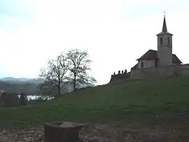 View of the church of Saint-Alban-de-Montbel next to the Lac d'Aiguebelette | |
Location of Saint-Alban-de-Montbel | |
 Saint-Alban-de-Montbel  Saint-Alban-de-Montbel | |
| Coordinates: 45°33′09″N 5°47′03″E / 45.5525°N 5.7842°E | |
| Country | France |
| Region | Auvergne-Rhône-Alpes |
| Department | Savoie |
| Arrondissement | Chambéry |
| Canton | Le Pont-de-Beauvoisin |
| Intercommunality | Lac d'Aiguebelette |
| Government | |
| • Mayor (2020–2026) | Pierre Duperchy[1] |
| Area 1 | 4.55 km2 (1.76 sq mi) |
| Population | 681 |
| • Density | 150/km2 (390/sq mi) |
| Time zone | UTC+01:00 (CET) |
| • Summer (DST) | UTC+02:00 (CEST) |
| INSEE/Postal code | 73219 /73610 |
| Elevation | 372–528 m (1,220–1,732 ft) |
| Website | www.stalbandemontbel.fr |
| 1 French Land Register data, which excludes lakes, ponds, glaciers > 1 km2 (0.386 sq mi or 247 acres) and river estuaries. | |
Saint-Alban-de-Montbel (French pronunciation: [sɛ̃.t‿albɑ̃ də mɔ̃bɛl]) is a commune in the Savoie department in the Auvergne-Rhône-Alpes region in south-eastern France.
World Heritage Site
It is home to one or more prehistoric pile-dwelling (or stilt house) settlements that are part of the Prehistoric Pile dwellings around the Alps UNESCO World Heritage Site.[3]
See also
References
- ↑ "Répertoire national des élus: les maires" (in French). data.gouv.fr, Plateforme ouverte des données publiques françaises. 13 September 2022.
- ↑ "Populations légales 2021". The National Institute of Statistics and Economic Studies. 28 December 2023.
- ↑ UNESCO World Heritage Site - Prehistoric Pile dwellings around the Alps
Wikimedia Commons has media related to Saint-Alban-de-Montbel.
External links
This article is issued from Wikipedia. The text is licensed under Creative Commons - Attribution - Sharealike. Additional terms may apply for the media files.