Saint-Alexandre-de-Kamouraska | |
|---|---|
 | |
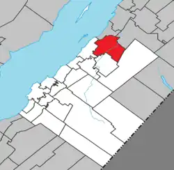 Location within Kamouraska RCM | |
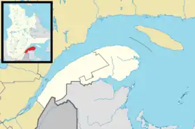 Saint-Alexandre-de-Kamouraska Location in eastern Quebec | |
| Coordinates: 47°40′54″N 69°37′30″W / 47.68167°N 69.62500°W[1] | |
| Country | Canada |
| Province | |
| Region | Bas-Saint-Laurent |
| RCM | Kamouraska |
| Constituted | July 1, 1855 |
| Government | |
| • Mayor | Victor Morin |
| • Federal riding | Montmagny—L'Islet—Kamouraska—Rivière-du-Loup |
| • Prov. riding | Côte-du-Sud |
| Area | |
| • Total | 116.50 km2 (44.98 sq mi) |
| • Land | 111.49 km2 (43.05 sq mi) |
| Population (2011)[3] | |
| • Total | 2,050 |
| • Density | 18.4/km2 (48/sq mi) |
| • Pop 2006–2011 | |
| • Dwellings | 870 |
| Time zone | UTC−5 (EST) |
| • Summer (DST) | UTC−4 (EDT) |
| Postal code(s) | |
| Area code(s) | 418 and 581 |
| Highways | |
| Website | www |
Saint-Alexandre-de-Kamouraska is a municipality in the Canadian province of Quebec, in the Kamouraska Regional County Municipality.
Before July 5, 1997, it was known simply as Saint-Alexandre.
History
The parish of Saint-Alexandre was founded in the first half of the 19th century.[1] It was canonically erected in 1851.[1] The post office was first opened in 1854 under the name "Saint-Alexandre-de-Kamouraska".[1] The parish municipality of Saint-Alexandre was then created in 1855.[1] In 1997, its status was changed to a municipality alongside its name, which became Saint-Alexandre-de-Kamouraska.[1]
Geography
Lakes and rivers
The following waterways pass through or are situated within the municipality's boundaries:[1]
- Lac Morin (47°37′23″N 69°32′08″W / 47.62306°N 69.53556°W) – located along the municipality's southern border.
- Le Petit Lac (47°40′10″N 69°33′41″W / 47.66944°N 69.56139°W)
- Petite rivière Noire (47°41′38″N 69°32′33″W / 47.69389°N 69.54250°W)
- Rivière Carrier (47°40′11″N 69°30′42″W / 47.66972°N 69.51167°W)
- Rivière Fourchue (47°41′19″N 69°32′31″W / 47.68861°N 69.54194°W)
See also
References
- 1 2 3 4 5 6 7 "Banque de noms de lieux du Québec: Reference number 333323". toponymie.gouv.qc.ca (in French). Commission de toponymie du Québec.
- 1 2 "Répertoire des municipalités: Geographic code 14035". www.mamh.gouv.qc.ca (in French). Ministère des Affaires municipales et de l'Habitation.
- 1 2 "Saint-Alexandre-de-Kamouraska (Code 2414035) Census Profile". 2011 census. Government of Canada - Statistics Canada.
External links
 Media related to Saint-Alexandre-de-Kamouraska at Wikimedia Commons
Adjacent Municipal Subdivisions | ||||||||||||||||
|---|---|---|---|---|---|---|---|---|---|---|---|---|---|---|---|---|
| ||||||||||||||||
| Cities and towns | |
|---|---|
| Municipalities | |
| Parishes | |
| Unorganized territories | |
| |
This article is issued from Wikipedia. The text is licensed under Creative Commons - Attribution - Sharealike. Additional terms may apply for the media files.