Saint-André-d'Apchon | |
|---|---|
Commune | |
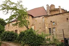 Chateau | |
.svg.png.webp) Coat of arms | |
Location of Saint-André-d'Apchon | |
 Saint-André-d'Apchon  Saint-André-d'Apchon | |
| Coordinates: 46°01′59″N 3°55′52″E / 46.0331°N 3.9311°E | |
| Country | France |
| Region | Auvergne-Rhône-Alpes |
| Department | Loire |
| Arrondissement | Roanne |
| Canton | Renaison |
| Intercommunality | Roannais Agglomération |
| Government | |
| • Mayor (2020–2026) | Martine Roffat[1] |
| Area 1 | 13.44 km2 (5.19 sq mi) |
| Population | 1,912 |
| • Density | 140/km2 (370/sq mi) |
| Time zone | UTC+01:00 (CET) |
| • Summer (DST) | UTC+02:00 (CEST) |
| INSEE/Postal code | 42199 /42370 |
| Elevation | 327–808 m (1,073–2,651 ft) (avg. 416 m or 1,365 ft) |
| 1 French Land Register data, which excludes lakes, ponds, glaciers > 1 km2 (0.386 sq mi or 247 acres) and river estuaries. | |
Saint-André-d'Apchon (French pronunciation: [sɛ̃.t‿ɑ̃dʁe dapʃɔ̃]) is a commune in the Loire department in central France.[3]
Population
| Year | Pop. | ±% p.a. |
|---|---|---|
| 1968 | 1,154 | — |
| 1975 | 1,347 | +2.23% |
| 1982 | 1,699 | +3.37% |
| 1990 | 1,720 | +0.15% |
| 1999 | 1,741 | +0.13% |
| 2009 | 1,876 | +0.75% |
| 2014 | 1,947 | +0.75% |
| 2020 | 1,920 | −0.23% |
| Source: INSEE[4] | ||
See also
References
- ↑ "Répertoire national des élus: les maires". data.gouv.fr, Plateforme ouverte des données publiques françaises (in French). 2 December 2020.
- ↑ "Populations légales 2021". The National Institute of Statistics and Economic Studies. 28 December 2023.
- ↑ INSEE commune file
- ↑ Population en historique depuis 1968, INSEE
External links
Wikimedia Commons has media related to Saint-André-d'Apchon.
This article is issued from Wikipedia. The text is licensed under Creative Commons - Attribution - Sharealike. Additional terms may apply for the media files.