Saint-Jean-de-la-Léqueraye | |
|---|---|
Part of Le Mesnil-Saint-Jean | |
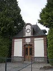 Town hall | |
Location of Saint-Jean-de-la-Léqueraye | |
 Saint-Jean-de-la-Léqueraye  Saint-Jean-de-la-Léqueraye | |
| Coordinates: 49°13′29″N 0°33′49″E / 49.2247°N 0.5636°E | |
| Country | France |
| Region | Normandy |
| Department | Eure |
| Arrondissement | Bernay |
| Canton | Beuzeville |
| Commune | Le Mesnil-Saint-Jean |
| Area 1 | 4.67 km2 (1.80 sq mi) |
| Population (2019)[1] | 68 |
| • Density | 15/km2 (38/sq mi) |
| Time zone | UTC+01:00 (CET) |
| • Summer (DST) | UTC+02:00 (CEST) |
| Postal code | 27560 |
| Elevation | 120–165 m (394–541 ft) (avg. 168 m or 551 ft) |
| 1 French Land Register data, which excludes lakes, ponds, glaciers > 1 km2 (0.386 sq mi or 247 acres) and river estuaries. | |
Saint-Jean-de-la-Léqueraye (French pronunciation: [sɛ̃ ʒɑ̃ də la lek(ə)ʁɛ]) is a former commune in the Eure department in Normandy in northern France. On 1 January 2019, it was merged into the new commune Le Mesnil-Saint-Jean.[2]
Population
| Year | Pop. | ±% |
|---|---|---|
| 1962 | 47 | — |
| 1968 | 71 | +51.1% |
| 1975 | 57 | −19.7% |
| 1982 | 51 | −10.5% |
| 1990 | 37 | −27.5% |
| 1999 | 46 | +24.3% |
| 2008 | 49 | +6.5% |
See also
References
- ↑ Téléchargement du fichier d'ensemble des populations légales en 2019, INSEE
- ↑ Arrêté préfectoral 25 September 2018 (in French)
Wikimedia Commons has media related to Saint-Jean-de-la-Léqueraye.
This article is issued from Wikipedia. The text is licensed under Creative Commons - Attribution - Sharealike. Additional terms may apply for the media files.