Saint-Lieux-Lafenasse | |
|---|---|
Part of Terre-de-Bancalié | |
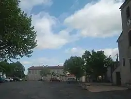 The main plaza in Lafenasse | |
.svg.png.webp) Coat of arms | |
Location of Saint-Lieux-Lafenasse | |
 Saint-Lieux-Lafenasse  Saint-Lieux-Lafenasse | |
| Coordinates: 43°46′09″N 2°13′47″E / 43.7692°N 2.2297°E | |
| Country | France |
| Region | Occitania |
| Department | Tarn |
| Arrondissement | Albi |
| Canton | Le Haut Dadou |
| Commune | Terre-de-Bancalié |
| Area 1 | 12.19 km2 (4.71 sq mi) |
| Population (2019)[1] | 456 |
| • Density | 37/km2 (97/sq mi) |
| Time zone | UTC+01:00 (CET) |
| • Summer (DST) | UTC+02:00 (CEST) |
| Postal code | 81120 |
| Elevation | 197–365 m (646–1,198 ft) (avg. 320 m or 1,050 ft) |
| 1 French Land Register data, which excludes lakes, ponds, glaciers > 1 km2 (0.386 sq mi or 247 acres) and river estuaries. | |
Saint-Lieux-Lafenasse (Languedocien: Sant Lionç e La Fenassa) is a former commune in the Tarn department in southern France. On 1 January 2019, it was merged into the new commune Terre-de-Bancalié.[2]
Geography
The commune is traversed by the river Dadou.
See also
References
- ↑ Téléchargement du fichier d'ensemble des populations légales en 2019, INSEE
- ↑ Arrêté préfectoral 29 November 2018 (in French)
Wikimedia Commons has media related to Saint-Lieux-Lafenasse.
This article is issued from Wikipedia. The text is licensed under Creative Commons - Attribution - Sharealike. Additional terms may apply for the media files.