Saint-Mathieu-du-Parc | |
|---|---|
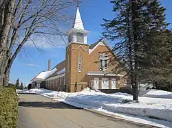 Saint-Mathieu Church | |
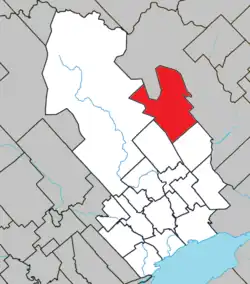 Location within Maskinongé RCM. | |
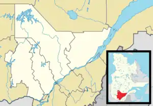 Saint-Mathieu-du-Parc Location in central Quebec. | |
| Coordinates: 46°34′N 72°55′W / 46.567°N 72.917°W[1] | |
| Country | |
| Province | |
| Region | Mauricie |
| RCM | Maskinongé |
| Constituted | June 30, 1886 |
| Government | |
| • Mayor | Claude Mayrand |
| • Federal riding | Berthier—Maskinongé |
| • Prov. riding | Saint-Maurice |
| Area | |
| • Total | 228.10 km2 (88.07 sq mi) |
| • Land | 218.85 km2 (84.50 sq mi) |
| Population (2021)[3] | |
| • Total | 1,482 |
| • Density | 6.8/km2 (18/sq mi) |
| • Pop 2016-2021 | |
| • Dwellings | 1,164 |
| Time zone | UTC−5 (EST) |
| • Summer (DST) | UTC−4 (EDT) |
| Postal code(s) | |
| Area code | 819 |
| Highways | |
| Website | www |
Saint-Mathieu-du-Parc is a municipality in the Mauricie region of the province of Quebec in Canada. Prior to March 28, 1998, it was known simply as Saint-Mathieu.
It is home to the Mokotakan Museum, showcasing the First Nations of Quebec.
References
- ↑ "Banque de noms de lieux du Québec: Reference number 342502". toponymie.gouv.qc.ca (in French). Commission de toponymie du Québec.
- 1 2 "Répertoire des municipalités: Geographic code 51070". www.mamh.gouv.qc.ca (in French). Ministère des Affaires municipales et de l'Habitation.
- 1 2 "Data table, Census Profile, 2021 Census of Population - Saint-Mathieu-du-Parc, Municipalité (MÉ) [Census subdivision], Quebec". 9 February 2022.
External links
 Media related to Saint-Mathieu-du-Parc at Wikimedia Commons
Places adjacent to Saint-Mathieu-du-Parc, Quebec | ||||||||||||||||
|---|---|---|---|---|---|---|---|---|---|---|---|---|---|---|---|---|
| ||||||||||||||||
| Cities & towns | |
|---|---|
| Municipalities | |
| Parishes | |
This article is issued from Wikipedia. The text is licensed under Creative Commons - Attribution - Sharealike. Additional terms may apply for the media files.