Saint-Michel-Chef-Chef | |
|---|---|
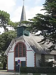 The chapel of Saint-Anne de Tharon, in Saint-Michel-Chef-Chef | |
 Coat of arms | |
Location of Saint-Michel-Chef-Chef | |
 Saint-Michel-Chef-Chef  Saint-Michel-Chef-Chef | |
| Coordinates: 47°10′54″N 2°08′50″W / 47.1817°N 2.1472°W | |
| Country | France |
| Region | Pays de la Loire |
| Department | Loire-Atlantique |
| Arrondissement | Saint-Nazaire |
| Canton | Pornic |
| Intercommunality | CA Pornic Agglo Pays de Retz |
| Government | |
| • Mayor (2020–2026) | Eloïse Bourreau-Gobin[1] |
| Area 1 | 25.12 km2 (9.70 sq mi) |
| Population | 5,324 |
| • Density | 210/km2 (550/sq mi) |
| Time zone | UTC+01:00 (CET) |
| • Summer (DST) | UTC+02:00 (CEST) |
| INSEE/Postal code | 44182 /44730 |
| 1 French Land Register data, which excludes lakes, ponds, glaciers > 1 km2 (0.386 sq mi or 247 acres) and river estuaries. | |
Saint-Michel-Chef-Chef (French pronunciation: [sɛ̃ miʃɛl ʃɛf ʃɛf] ⓘ; Breton: Sant-Mikael-Keveger) is a commune in the Loire-Atlantique department in western France.[3]
Population
| Year | Pop. | ±% p.a. |
|---|---|---|
| 1968 | 2,242 | — |
| 1975 | 2,447 | +1.26% |
| 1982 | 2,517 | +0.40% |
| 1990 | 2,663 | +0.71% |
| 1999 | 3,177 | +1.98% |
| 2007 | 4,234 | +3.66% |
| 2012 | 4,503 | +1.24% |
| 2017 | 4,993 | +2.09% |
| Source: INSEE[4] | ||
See also
References
- ↑ "Répertoire national des élus: les maires". data.gouv.fr, Plateforme ouverte des données publiques françaises (in French). 2 December 2020.
- ↑ "Populations légales 2021". The National Institute of Statistics and Economic Studies. 28 December 2023.
- ↑ INSEE commune file
- ↑ Population en historique depuis 1968, INSEE
External links
Wikimedia Commons has media related to Saint-Michel-Chef-Chef.
This article is issued from Wikipedia. The text is licensed under Creative Commons - Attribution - Sharealike. Additional terms may apply for the media files.