Saint-Pierre-de-Lamps | |
|---|---|
Part of Levroux | |
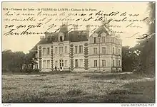 An old postcard view of the château | |
Location of Saint-Pierre-de-Lamps | |
 Saint-Pierre-de-Lamps  Saint-Pierre-de-Lamps | |
| Coordinates: 46°58′19″N 1°30′48″E / 46.9719°N 1.5133°E | |
| Country | France |
| Region | Centre-Val de Loire |
| Department | Indre |
| Arrondissement | Châteauroux |
| Canton | Levroux |
| Commune | Levroux |
| Area 1 | 10.28 km2 (3.97 sq mi) |
| Population (2018)[1] | 54 |
| • Density | 5.3/km2 (14/sq mi) |
| Time zone | UTC+01:00 (CET) |
| • Summer (DST) | UTC+02:00 (CEST) |
| Postal code | 36110 |
| Elevation | 138–185 m (453–607 ft) (avg. 140 m or 460 ft) |
| 1 French Land Register data, which excludes lakes, ponds, glaciers > 1 km2 (0.386 sq mi or 247 acres) and river estuaries. | |
Saint-Pierre-de-Lamps (French pronunciation: [sɛ̃ pjɛʁ də lɑ̃]) is a former commune in the Indre department in central France.[2] On 1 January 2019, it was merged into the commune Levroux, and became a delegated commune.[3]
Population
|
|
See also
Ancienne carte postale du château de Saint-Pierre de Lamps dans l'Indre
References
- ↑ Téléchargement du fichier d'ensemble des populations légales en 2018, INSEE
- ↑ INSEE commune file
- ↑ Arrêté préfectoral 24 August 2018 (in French)
Wikimedia Commons has media related to Saint-Pierre-de-Lamps.
This article is issued from Wikipedia. The text is licensed under Creative Commons - Attribution - Sharealike. Additional terms may apply for the media files.