Saint-Polycarpe | |
|---|---|
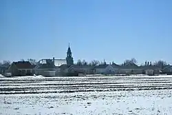
 Church of Saint-Polycarpe | |
| Motto(s): travail, progrès et égalité pour tous (work, progress, and equality for all) | |
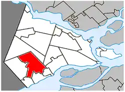
 Location within Vaudreuil-Soulanges RCM | |
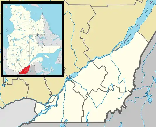
 St-Polycarpe Location in southern Quebec | |
| Coordinates: 45°18′N 74°18′W / 45.3°N 74.3°W[1] | |
| Country | Canada |
| Province | Quebec |
| Region | Montérégie |
| RCM | Vaudreuil-Soulanges |
| Constituted | 31 December 1988 |
| Government | |
| • Mayor | Jean-Yves Poirier |
| • Federal riding | Salaberry—Suroît |
| • Prov. riding | Soulanges |
| Area | |
| • Total | 70.73 km2 (27.31 sq mi) |
| • Land | 69.88 km2 (26.98 sq mi) |
| Population (2021)[4] | |
| • Total | 2,372 |
| • Density | 33.9/km2 (88/sq mi) |
| • Pop 2016-2021 | |
| • Dwellings | 1,030 |
| Time zone | UTC−5 (EST) |
| • Summer (DST) | UTC−4 (EDT) |
| Postal code(s) | |
| Area code(s) | 450 and 579 |
| Highways | |
| Website | munstpolycarpe |
Saint-Polycarpe (French pronunciation: [sɛ̃ pɔlikaʁp] ⓘ) is a municipality located in the Vaudreuil-Soulanges Regional County Municipality in the Montérégie region west of Montreal, Quebec, Canada, and just east of the Quebec-Ontario border. It was named for Polycarp, a 2nd-century bishop of Smyrna. The population as of the 2021 Canadian Census was 2,372.
While a parish during the 18th century, its territory included portions of what is now part of Saint-Zotique.
History
Settlement began around 1800 when a sawmill and a flour mill were built at the rapids of the Delisle river. In 1818, a chapel was built there and in 1830, the parish was established, called Saint-Polycarpe de la Nouvelle-Longueuil. Its post office was built in 1846.[1][5]
In 1845, the Municipality of La Nouvelle-Longueuil was created, but abolished in 1847. In 1855, it was recreated out of Vaudreuil County as the Parish Municipality of Saint-Polycarpe. In 1887, the village itself split off from the surrounding rural parish to form the Village Municipality of Saint-Polycarpe.[1]
On December 31, 1988, the parish and village merged again to form the Municipality of Saint-Polycarpe.[1]
Demographics
| 2021 | 2016 | 2011 | |
|---|---|---|---|
| Population | 2,372 (6.7% from 2016) | 2,224 (+13.0% from 2011) | 1,969 (+15.3% from 2006) |
| Land area | 69.88 km2 (26.98 sq mi) | 70.00 km2 (27.03 sq mi) | 69.97 km2 (27.02 sq mi) |
| Population density | 33.9/km2 (88/sq mi) | 31.8/km2 (82/sq mi) | 28.1/km2 (73/sq mi) |
| Median age | 38.4 (M: 38.8, F: 38.0) | 37.7 (M: 38.2, F: 37.2) | 37.2 (M: 38.3, F: 36.1) |
| Private dwellings | 1,030 (total) | 947 (total) | 829 (total) |
| Median household income | $62,144 | $52,451 |
|
| ||||||||||||||||||||||||||||||||||||
| Population amounts prior to 1988 are total of Saint-Polycarpe Parish and Saint-Polycarpe Village. Source: Statistics Canada[11] | |||||||||||||||||||||||||||||||||||||
Language
| Canada Census Mother Tongue - Saint-Polycarpe, Quebec[11] | ||||||||||||||||||
|---|---|---|---|---|---|---|---|---|---|---|---|---|---|---|---|---|---|---|
| Census | Total | French |
English |
French & English |
Other | |||||||||||||
| Year | Responses | Count | Trend | Pop % | Count | Trend | Pop % | Count | Trend | Pop % | Count | Trend | Pop % | |||||
2016 |
2,225 |
2,010 | 90.3% | 100 | 4.5% | 25 | 1.1% | 90 | 4.0% | |||||||||
2011 |
1,965 |
1,790 | 91.09% | 95 | 4.83% | 15 | 0.76% | 65 | 3.31% | |||||||||
2006 |
1,710 |
1,625 | 95.03% | 35 | 2.05% | 10 | 0.58% | 40 | 2.34% | |||||||||
2001 |
1,640 |
1,590 | 96.95% | 50 | 3.05% | 0 | 0.00% | 0 | 0.00% | |||||||||
1996 |
1,650 |
1,500 | n/a | 90.91% | 130 | n/a | 7.88% | 10 | n/a | 0.61% | 10 | n/a | 0.61% | |||||
Local government
List of former mayors (since formation of current municipality):[12]
- Joseph-Donat-Normand Ménard (1989–2012)
- Roland Daneau (2012–2013)
- Jean Yves Poirier (2013–present)
Infrastructure

Transportation
Saint-Polycarpe is located along Route 340 with nearby Quebec Autoroute 20 running south of the municipality.
Education
Commission Scolaire des Trois-Lacs operates Francophone schools.[13]
- École secondaire Soulanges
- École du Val-des-Prés Sacré-Cœur
Lester B. Pearson School Board operates Anglophone schools.[14]
- Soulanges Elementary School in Saint-Télesphore or Evergreen Elementary and Forest Hill Elementary (Junior Campus and Senior campus) in Saint-Lazare
Points of interest
- Natura Farm
- Saint-Polycarpe Municipal Library
- Schoune Brewery Farm
- Soulanges Sports Centre
- Soulanges Volunteer Action Centre
Climate
Based on the Dalhousie Mills station in Saint-Télesphore
| Climate data for Saint-Polycarpe | |||||||||||||
|---|---|---|---|---|---|---|---|---|---|---|---|---|---|
| Month | Jan | Feb | Mar | Apr | May | Jun | Jul | Aug | Sep | Oct | Nov | Dec | Year |
| Record high °C (°F) | 11.5 (52.7) |
14.0 (57.2) |
23.0 (73.4) |
31.5 (88.7) |
32.2 (90.0) |
34.0 (93.2) |
34.0 (93.2) |
35.0 (95.0) |
36.5 (97.7) |
27.8 (82.0) |
21.5 (70.7) |
17.5 (63.5) |
36.5 (97.7) |
| Mean daily maximum °C (°F) | −5.9 (21.4) |
−3.2 (26.2) |
−2.3 (27.9) |
11.2 (52.2) |
18.9 (66.0) |
23.6 (74.5) |
26.1 (79.0) |
25.1 (77.2) |
20.4 (68.7) |
13.0 (55.4) |
5.4 (41.7) |
−1.6 (29.1) |
11.3 (52.3) |
| Daily mean °C (°F) | −11.1 (12.0) |
−8.9 (16.0) |
−2.9 (26.8) |
5.6 (42.1) |
12.6 (54.7) |
17.5 (63.5) |
20.0 (68.0) |
18.9 (66.0) |
14.4 (57.9) |
7.7 (45.9) |
1.2 (34.2) |
−6.1 (21.0) |
5.8 (42.4) |
| Mean daily minimum °C (°F) | −16.2 (2.8) |
−14.5 (5.9) |
−8.1 (17.4) |
-0.0 (32.0) |
6.3 (43.3) |
11.4 (52.5) |
13.9 (57.0) |
12.7 (54.9) |
8.3 (46.9) |
2.3 (36.1) |
−2.9 (26.8) |
−10.5 (13.1) |
0.2 (32.4) |
| Record low °C (°F) | −41.0 (−41.8) |
−40 (−40) |
−34 (−29) |
−16.1 (3.0) |
−5.0 (23.0) |
−2.5 (27.5) |
3.5 (38.3) |
−0.6 (30.9) |
−6.0 (21.2) |
−10.0 (14.0) |
−23.0 (−9.4) |
−38.3 (−36.9) |
−41.0 (−41.8) |
| Average precipitation mm (inches) | 91.5 (3.60) |
74.2 (2.92) |
77.7 (3.06) |
87.0 (3.43) |
93.0 (3.66) |
100.4 (3.95) |
93.3 (3.67) |
89.2 (3.51) |
95.2 (3.75) |
91.4 (3.60) |
100.7 (3.96) |
83.7 (3.30) |
1,077.2 (42.41) |
| Average rainfall mm (inches) | 32.0 (1.26) |
26.9 (1.06) |
34.1 (1.34) |
70.8 (2.79) |
92.8 (3.65) |
100.4 (3.95) |
93.3 (3.67) |
89.2 (3.51) |
95.2 (3.75) |
88.4 (3.48) |
78.8 (3.10) |
36.6 (1.44) |
838.5 (33.01) |
| Average snowfall cm (inches) | 59.6 (23.5) |
47.2 (18.6) |
43.6 (17.2) |
16.2 (6.4) |
0.2 (0.1) |
0.0 (0.0) |
0.0 (0.0) |
0.0 (0.0) |
0.0 (0.0) |
3.0 (1.2) |
21.9 (8.6) |
47.0 (18.5) |
238.7 (94.0) |
| Source: Environment Canada[15] | |||||||||||||
See also
References
- 1 2 3 4 "Banque de noms de lieux du Québec: Reference number 224196". toponymie.gouv.qc.ca (in French). Commission de toponymie du Québec.
- 1 2 "Répertoire des municipalités: Saint-Polycarpe". www.mamh.gouv.qc.ca (in French). Ministère des Affaires municipales et de l'Habitation. Retrieved 12 May 2022.
- ↑ Parliament of Canada Federal Riding History: VAUDREUIL--SOULANGES (Quebec)
- 1 2 "Saint-Polycarpe, Municipalité (MÉ) Census Profile, 2021 Census of Population". www12.statcan.gc.ca. Government of Canada - Statistics Canada. Retrieved 12 May 2022.
- ↑ "Histoire" (in French). Municipalité de Saint-Polycarpe. Retrieved 6 January 2022.
- ↑ "2021 Community Profiles". 2021 Canadian Census. Statistics Canada. 4 February 2022. Retrieved 12 May 2022.
- ↑ "2016 Community Profiles". 2016 Canadian Census. Statistics Canada. 12 August 2021. Retrieved 25 November 2019.
- ↑ "2011 Community Profiles". 2011 Canadian Census. Statistics Canada. 21 March 2019. Retrieved 15 February 2014.
- ↑ "2006 Community Profiles". 2006 Canadian Census. Statistics Canada. 20 August 2019.
- ↑ "2001 Community Profiles". 2001 Canadian Census. Statistics Canada. 18 July 2021.
- 1 2 1996, 2001, 2006, 2011 census
- ↑ "Répertoire des entités géopolitiques: Saint-Polycarpe (municipalité) 31.12.1988 - ..." www.mairesduquebec.com. Institut généalogique Drouin. Retrieved 6 January 2022.
- ↑ "Les écoles et les centres". Commission Scolaire des Trois-Lacs. Retrieved 18 January 2013.
- ↑ "School Board Map." Lester B. Pearson School Board. Retrieved on 28 September 2017.
- ↑ "Dalhousie Mills Climate". Canadian Climate Normals 1981–2010 (in English and French). Environment Canada. 31 October 2011. Retrieved 29 July 2022.