Saint-Sornin-Leulac | |
|---|---|
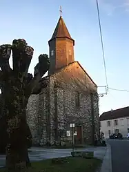 The church in Saint-Sornin-Leulac | |
.svg.png.webp) Coat of arms | |
Location of Saint-Sornin-Leulac | |
 Saint-Sornin-Leulac  Saint-Sornin-Leulac | |
| Coordinates: 46°12′00″N 1°17′54″E / 46.20000°N 1.2983°E | |
| Country | France |
| Region | Nouvelle-Aquitaine |
| Department | Haute-Vienne |
| Arrondissement | Bellac |
| Canton | Châteauponsac |
| Intercommunality | Gartempe – Saint Pardoux |
| Government | |
| • Mayor (2020–2026) | Didier Pinel[1] |
| Area 1 | 32.28 km2 (12.46 sq mi) |
| Population | 566 |
| • Density | 18/km2 (45/sq mi) |
| Time zone | UTC+01:00 (CET) |
| • Summer (DST) | UTC+02:00 (CEST) |
| INSEE/Postal code | 87180 /87290 |
| Elevation | 246–365 m (807–1,198 ft) |
| 1 French Land Register data, which excludes lakes, ponds, glaciers > 1 km2 (0.386 sq mi or 247 acres) and river estuaries. | |
Saint-Sornin-Leulac (French pronunciation: [sɛ̃ sɔʁnɛ̃ lølak]; Occitan: Sent Sòrnin) is a commune in the Haute-Vienne department in the Nouvelle-Aquitaine region in west-central France.
Geography
The river Brame flows westward through the northern part of the commune.
See also
References
- ↑ "Répertoire national des élus: les maires". data.gouv.fr, Plateforme ouverte des données publiques françaises (in French). 2 December 2020.
- ↑ "Populations légales 2021". The National Institute of Statistics and Economic Studies. 28 December 2023.
Wikimedia Commons has media related to Saint-Sornin-Leulac.
This article is issued from Wikipedia. The text is licensed under Creative Commons - Attribution - Sharealike. Additional terms may apply for the media files.