Saint-Valérien | |
|---|---|
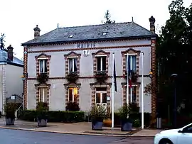 The town hall in Saint-Valérien | |
.svg.png.webp) Coat of arms | |
Location of Saint-Valérien | |
 Saint-Valérien  Saint-Valérien | |
| Coordinates: 48°10′48″N 3°05′45″E / 48.18000°N 3.0958°E | |
| Country | France |
| Region | Bourgogne-Franche-Comté |
| Department | Yonne |
| Arrondissement | Sens |
| Canton | Gâtinais en Bourgogne |
| Government | |
| • Mayor (2020–2026) | Jérôme Cordier[1] |
| Area 1 | 22.31 km2 (8.61 sq mi) |
| Population | 1,771 |
| • Density | 79/km2 (210/sq mi) |
| Time zone | UTC+01:00 (CET) |
| • Summer (DST) | UTC+02:00 (CEST) |
| INSEE/Postal code | 89370 /89150 |
| Elevation | 137–181 m (449–594 ft) |
| 1 French Land Register data, which excludes lakes, ponds, glaciers > 1 km2 (0.386 sq mi or 247 acres) and river estuaries. | |
Saint-Valérien (French pronunciation: [sɛ̃ valeʁjɛ̃]) is a commune in the Yonne department in Bourgogne-Franche-Comté in north-central France.
See also
References
- ↑ "Répertoire national des élus: les maires" (in French). data.gouv.fr, Plateforme ouverte des données publiques françaises. 13 September 2022.
- ↑ "Populations légales 2021". The National Institute of Statistics and Economic Studies. 28 December 2023.
Wikimedia Commons has media related to Saint-Valérien (Yonne).
This article is issued from Wikipedia. The text is licensed under Creative Commons - Attribution - Sharealike. Additional terms may apply for the media files.