Sainte-Irène | |
|---|---|
 Val-d'Irène Ski Resort (685 m (2,247 ft)) | |
| Motto: Où le vent tourne à nos espérances | |
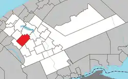 Location within La Matapédia RCM. | |
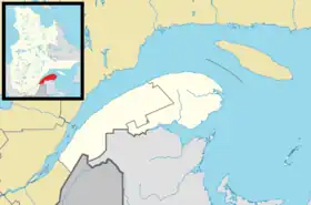 Sainte-Irène Location in eastern Quebec. | |
| Coordinates: 48°26′N 67°36′W / 48.433°N 67.600°W[1] | |
| Country | |
| Province | |
| Region | Bas-Saint-Laurent |
| RCM | La Matapédia |
| Settled | c. 1930 |
| Constituted | January 1, 1953 |
| Government | |
| • Mayor | Sébastien Lévesque |
| • Federal riding | Avignon—La Mitis—Matane—Matapédia |
| • Prov. riding | Matane-Matapédia |
| Area | |
| • Total | 135.20 km2 (52.20 sq mi) |
| • Land | 135.09 km2 (52.16 sq mi) |
| Population | |
| • Total | 369 |
| • Density | 2.7/km2 (7/sq mi) |
| • Pop 2016-2021 | |
| • Dwellings | 246 |
| Time zone | UTC−5 (EST) |
| • Summer (DST) | UTC−4 (EDT) |
| Postal code(s) | |
| Area code(s) | 418 and 581 |
| Highways | No major routes |
| Website | www |
Sainte-Irène is a parish municipality in Quebec, Canada.
Demographics
| Year | Pop. | ±% |
|---|---|---|
| 1956 | 1,102 | — |
| 1961 | 955 | −13.3% |
| 1966 | 748 | −21.7% |
| 1971 | 549 | −26.6% |
| 1976 | 396 | −27.9% |
| 1981 | 351 | −11.4% |
| 1986 | 343 | −2.3% |
| 1991 | 363 | +5.8% |
| 1996 | 352 | −3.0% |
| 2001 | 323 | −8.2% |
| 2006 | 350 | +8.4% |
| 2011 | 341 | −2.6% |
| 2016 | 327 | −4.1% |
| 2021 | 369 | +12.8% |
In the 2021 Census of Population conducted by Statistics Canada, Sainte-Irène had a population of 369 living in 174 of its 246 total private dwellings, a change of 12.8% from its 2016 population of 327. With a land area of 135.09 km2 (52.16 sq mi), it had a population density of 2.7/km2 (7.1/sq mi) in 2021.[6]
| 2021 | 2016 | 2011 | |
|---|---|---|---|
| Population | 369 (12.8% from 2016) | 327 (-4.1% from 2011) | 341 (-2.6% from 2006) |
| Land area | 135.09 km2 (52.16 sq mi) | 135.25 km2 (52.22 sq mi) | 136.56 km2 (52.73 sq mi) |
| Population density | 2.7/km2 (7.0/sq mi) | 2.4/km2 (6.2/sq mi) | 2.5/km2 (6.5/sq mi) |
| Median age | 45.6 (M: 45.6, F: 46.0) | 46.9 (M: 48.8, F: 46.1) | 47.6 (M: 49.2, F: 43.5) |
| Private dwellings | 246 (total) | 259 (total) | 233 (total) |
| Median household income | $71,000 | $53,675 | $68,040 |
Governement
Municipal council
- Mayor: Sébastien Lévesque
- Councillors: Nathalie Daoust, Charli Fournier, Carmen Fournier, Nancy Lizotte, Alain Delisle, Nelson Thériault
Political representation
| Year | Liberal | Conservative | Bloc Québécois | New Democratic | Green | ||||||
|---|---|---|---|---|---|---|---|---|---|---|---|
| 2021 | 7% | 15 | 9% | 18 | 75% | 148 | 4% | 7 | 0% | 0 | |
| 2019 | 24% | 41 | 9% | 15 | 62% | 110 | 2% | 4 | 2% | 3 | |
| 2015 | 36% | 43 | 7% | 8 | 30% | 36 | 16% | 19 | 1% | 1 | |
| Year | CAQ | Liberal | QC solidaire | Parti Québécois | |||||
|---|---|---|---|---|---|---|---|---|---|
| 2018 | 12% | 24 | 8% | 15 | 6% | 12 | 72% | 140 | |
| 2014 | 11% | 20 | 16% | 29 | 10% | 18 | 64% | 117 | |
Provincially it is part of the riding of Matane-Matapédia. In the 2022 Quebec general election the incumbent MNA Pascal Bérubé, of the Parti Québécois, was re-elected to represent the population of Sainte-Irène in the National Assembly of Quebec.
Federally, Sainte-Irène is part of the federal riding of Avignon—La Mitis—Matane—Matapédia. In the 2021 Canadian federal election, the incumbent Kristina Michaud of the Bloc Québécois was re-elected to represent the population Sainte-Irène in the House of Commons of Canada.
See also
References
- ↑ "Banque de noms de lieux du Québec: Reference number 56213". toponymie.gouv.qc.ca (in French). Commission de toponymie du Québec.
- 1 2 "Sainte-Irène". Répertoire des municipalités (in French). Ministère des Affaires municipales, des Régions et de l'Occupation du territoire. Retrieved 2012-01-30.
- ↑ "Tableau de profil, Profil du recensement, Recensement de la population de 2021". 9 February 2022.
- ↑ "Tableau de profil, Profil du recensement, Recensement de la population de 2021". 9 February 2022.
- ↑ Statistics Canada: 1996, 2001, 2006, 2011, 2016, 2021 census
- ↑ "Population and dwelling counts: Canada, provinces and territories, and census subdivisions (municipalities), Quebec". Statistics Canada. February 9, 2022. Retrieved August 29, 2022.
- ↑ "2021 Community Profiles". 2021 Canadian Census. Statistics Canada. February 4, 2022. Retrieved 2022-08-23.
- ↑ "2016 Community Profiles". 2016 Canadian Census. Statistics Canada. August 12, 2021. Retrieved 2022-07-14.
- ↑ "2011 Community Profiles". 2011 Canadian Census. Statistics Canada. March 21, 2019. Retrieved 2014-02-07.
- ↑ "2006 Community Profiles". 2006 Canadian Census. Statistics Canada. August 20, 2019.
- ↑ "2001 Community Profiles". 2001 Canadian Census. Statistics Canada. July 18, 2021.
- ↑ "Official Voting Results Raw Data (poll by poll results in block 1529)". Elections Canada. Retrieved March 6, 2023.
- ↑ "Official Voting Results by polling station (poll by poll results in block 1529)". Elections Québec. Retrieved March 6, 2023.
Adjacent Municipal Subdivisions | |
|---|---|
| Cities & Towns | |
|---|---|
| Municipalities | |
| Parishes | |
| Villages | |
| Unorganized territories | |
| |