Sainte Marie Township | |
|---|---|
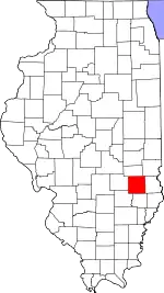
 Location in Jasper County | |
 Jasper County's location in Illinois | |
| Coordinates: 38°56′00″N 88°02′00″W / 38.93333°N 88.03333°W | |
| Country | United States |
| State | Illinois |
| County | Jasper |
| Established | November 8, 1859 |
| Area | |
| • Total | 43.06 sq mi (111.5 km2) |
| • Land | 42.95 sq mi (111.2 km2) |
| • Water | 0.11 sq mi (0.3 km2) 0.26% |
| Elevation | 479 ft (146 m) |
| Population (2010) | |
| • Total | 551 |
| • Density | 12.8/sq mi (4.9/km2) |
| Time zone | UTC-6 (CST) |
| • Summer (DST) | UTC-5 (CDT) |
| ZIP codes | 62448, 62449, 62459, 62475, 62480 |
| GNIS feature ID | 0422229 |
Sainte Marie Township is one of eleven townships in Jasper County, Illinois, United States. As of the 2010 census, its population was 551 and it contained 264 housing units.[1]
Geography
According to the 2010 census, the township has a total area of 43.06 square miles (111.5 km2), of which 42.95 square miles (111.2 km2) (or 99.74%) is land and 0.11 square miles (0.28 km2) (or 0.26%) is water.[1]
Cities, towns, villages
- Ste. Marie
- Rafetown[2]
Adjacent townships
- Willow Hill Township - north
- Oblong Township, Crawford County - northeast
- Martin Township, Crawford County - east
- Southwest Township, Crawford County - east
- German Township, Richland County - south
- Preston Township, Richland County - southwest
- Fox Township - west
Cemeteries
- St. Mary's Assumption
- Collins/Faltmier
- Ste Marie City
- St. Valentine/South Bend
- Yager
Rivers
- Dead River
- Embarras River
School districts
- Jasper County Community Unit School District 1
- Oblong Community Unit School District 4
Political districts
- Illinois's 19th congressional district
- State House District 108
- State Senate District 54
References
- "Sainte Marie Township, Jasper County, Illinois". Geographic Names Information System. United States Geological Survey, United States Department of the Interior. Retrieved January 17, 2010.
- United States Census Bureau 2007 TIGER/Line Shapefiles
- United States National Atlas
- 1 2 "Population, Housing Units, Area, and Density: 2010 - County -- County Subdivision and Place -- 2010 Census Summary File 1". US Census. Archived from the original on February 12, 2020. Retrieved May 28, 2013.
- ↑ Rafetown, Ste Marie Township, IL (Google Maps - accessed 12 January 2020)
External links
Municipalities and communities of Jasper County, Illinois, United States | ||
|---|---|---|
| Cities | Map of Illinois highlighting Jasper County | |
| Villages | ||
| Townships | ||
| CDP | ||
| Other communities | ||
This article is issued from Wikipedia. The text is licensed under Creative Commons - Attribution - Sharealike. Additional terms may apply for the media files.