Salkum, Washington | |
|---|---|
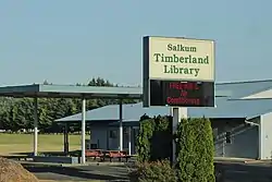
 Salkum Timberland Library in Salkum, WA | |
 Salkum  Salkum | |
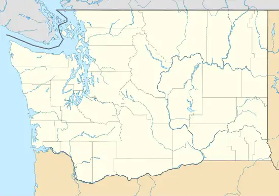
| Coordinates: 46°31′55″N 122°37′33″W / 46.53194°N 122.62583°W | |
| Country | United States |
| State | Washington |
| County | Lewis |
| Elevation | 558[1] ft (170 m) |
| Time zone | UTC-8 (Pacific (PST)) |
| • Summer (DST) | UTC-7 (PDT) |
| zip code | 98582 |
| Area code | 360 |
Salkum is a rural unincorporated community in Lewis County, Washington. The town is located on U.S. Route 12 and is 2.1 miles (3.4 km) west of Silver Creek.[1]
History
The area was a village of the Cowlitz Indian Tribe.[2] Salkum is a Cowlitz Indian word meaning "boiling water" or "boiling up", a reference to a nearby series of waterfalls on Mill Creek.[2][3][4]
The first non-Native settlers built a grist mill at Mill Creek in 1881, beginning the town's future.[5] A post office was established in 1882 and moved in 1890, shifting the town's center two miles north.[6] Salkum would become a timber community, producing lumber until the 1930s when the sawmills shut down.[2]
Salkum opened its first library, as part of the Timberland Regional Library system, in 1986 as a test to expand library services to rural communities. Proving successful, the community refurbished an unoccupied gas station and the library was moved into the larger building in 1993.[7][8][9]
Government and politics
Politics
| Year | Republican | Democratic | Third parties |
|---|---|---|---|
| 2020[10] | 70.82% 381 | 26.58% 143 | 1.39% 11 |
Salkum is recognized as being majority Republican and conservative.
Third parties receiving votes in the 2020 election were the Libertarian Party and Green Party, and there were 3 votes for Write-in candidates.
Infrastructure
Salkum is among 8 locations that are part of an EV installation project on the White Pass Scenic Byway. The program will stretch from the White Pass Ski Area to Chehalis and is run in partnership with Lewis County PUD, Twin Transit, state government agencies, and local community efforts. The venture began in 2023 from two grants totaling over $1.8 million.[11]
References
- 1 2 "Salkum". Geographic Names Information System. United States Geological Survey, United States Department of the Interior.
- 1 2 3 Mittge, Brian (April 6, 2002). "Salkum: Mill Town near Indian village site on Cowlitz River now perches on Highway 12". The Chronicle. p. 10. Retrieved December 15, 2021.
- ↑ "Byway Communities - Salkum". whitepassbyway.com. White Pass Scenic Byway. Retrieved July 26, 2021.
- ↑ "SALKUM (Mt. Hope) and MOUNT MORIAH MASONIC CEMETERIES". files.usgwarchives.net. US GenWeb Archives. Retrieved July 26, 2021.
- ↑ "Salkum site has moved". The Daily Chronicle. June 3, 1977. p. V27. Retrieved December 15, 2021.
- ↑ "Lewis County - Salkum". jtenlen.drizzlehosting.com. Lewis Co. WA GenWeb Project.
- ↑ Fund, Edna (August 11, 2011). "Salkum Library Opens". The Chronicle. Retrieved December 15, 2021.
- ↑ McDonald, Julie (June 1, 2021). "Timberland Regional Library Expands Services in Thurston". The Nisqually Valley News. Retrieved December 15, 2021.
- ↑ "Salkum Timberland Library". trl.org. Timberland Regional Library.
- ↑ "Lewis County 2020 Election". Results.Vote.WA. Results.Vote.WA. Retrieved July 25, 2021.
- ↑ The Chronicle staff (March 7, 2023). "Construction Begins on U.S. Highway 12 Electric Vehicle Charging Station Network". The Chronicle (Centralia, Washington). Retrieved June 21, 2023.
