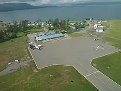
Sandspit Airport | |||||||||||
|---|---|---|---|---|---|---|---|---|---|---|---|
 | |||||||||||
| Summary | |||||||||||
| Airport type | Public | ||||||||||
| Operator | Transport Canada | ||||||||||
| Serves | Haida Gwaii | ||||||||||
| Location | Sandspit, British Columbia | ||||||||||
| Time zone | PST (UTC−08:00) | ||||||||||
| • Summer (DST) | PDT (UTC−07:00) | ||||||||||
| Elevation AMSL | 21 ft / 6 m | ||||||||||
| Coordinates | 53°15′15″N 131°48′50″W / 53.25417°N 131.81389°W | ||||||||||
| Map | |||||||||||
 CYZP Location in British Columbia | |||||||||||
| Runways | |||||||||||
| |||||||||||
| Statistics (2014) | |||||||||||
| |||||||||||
Sandspit Airport (IATA: YZP, ICAO: CYZP) is located 1.5 nautical miles (2.8 km; 1.7 mi) northeast of Sandspit, British Columbia, Canada.
Douglas DC-4 crash
On January 19, 1952, a Douglas DC-4 on Northwest Orient Airlines Flight 324 attempted to land at Sandspit Airport due to a failed engine.[4] Although the plane touched down on the runway, it lifted off again before coming to a halt. Unable to regain its lost speed and altitude, the aircraft hit the water about 4,500 feet (1,400 m) from the end of the runway. 36 of the 43 passengers and crew aboard died due to hypothermia or drowning.[4]
Airlines and destinations
| Airlines | Destinations |
|---|---|
| Air Canada Express | Vancouver |
| North Cariboo Air | Charter: Vancouver |
| R1 Airlines | Charter: Vancouver |
See also
References
- ↑ Canada Flight Supplement. Effective 0901Z 16 July 2020 to 0901Z 10 September 2020.
- ↑ Synoptic/Metstat Station Information
- ↑ Total aircraft movements by class of operation
- 1 2 "ASN Aircraft accident Douglas C-54E-5-DO N45342 Sandspit Airport, BC (YZP)". Aviation Safety Network. Retrieved January 24, 2019.
External links

Wind rose showing distribution of wind speed and direction for Sandspit Airport for the year 2016
- Past three hours METARs, SPECI and current TAFs for Sandspit Airport from Nav Canada as available.
This article is issued from Wikipedia. The text is licensed under Creative Commons - Attribution - Sharealike. Additional terms may apply for the media files.