Santa Rosa, California's Cultural Heritage Board recommends sites for Designated Landmark status. The City Council makes the final decisions regarding designations.[1][2]
Santa Rosa's designations are independent of state and federal designations; the Luther Burbank Home & Gardens however is also designated a California Historical Landmark and as a U.S. National Historic Landmark (and therefore is also listed on the National Register of Historic Places. The County of Sonoma's historic landmark designations intentionally exclude sites within the cities in the County.
List of Santa Rosa historic landmarks
| Landmark Number | Name | Location | Image | CHB Resolution No./ CHB Date |
CC Resolution No./ CC Date |
Notes | APNs |
|---|---|---|---|---|---|---|---|
| 1 | Miller Ranch (Stone Family Farm) | Occidental & Sanford Roads 38°25′31″N 122°49′31″W / 38.425217°N 122.825224°W |
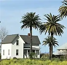 Stone Family Farm (Laguna Center) |
chb4/ 10/26/1988 |
130-250-14, 130-250-49, 130-250-50, 060-330-10 | ||
| 2 | De Turk Round Barn | 819 Donahue Street 38°26′27″N 122°43′31″W / 38.440815°N 122.725211°W |
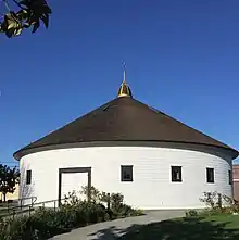 DeTurk Round Barn built in 1891 |
chb8/ 11/9/1988 |
Now in a city park available for rent for weddings and events. | 010-144-19 | |
| 3 | Carrillo Adobe | Montomery Drive38°26′55″N 122°41′01″W / 38.448548°N 122.683604°W |  Carrillo Adobe built in 1829 |
chb11/ 11/29/1988 |
013-271-01, 013-274-02 | ||
| 4 | Rosenberg Building | 306 Mendocino Avenue 38°26′27″N 122°42′51″W / 38.440837°N 122.714155°W |
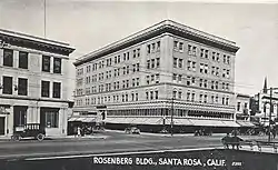 |
chb13/ 3/22/1989 |
009-011-02 | ||
| 5 | Bolton House | 966 Sonoma Avenue 38°26′24″N 122°42′11″W / 38.439968°N 122.702917°W |
 The Walter and Isabel Bolton House |
chb15/ 6/14/1989 |
009-211-81 | ||
| 6 | Tripp House | 1023 Fourth Street 38°26′39″N 122°42′24″W / 38.444032°N 122.706736°W |
 Tripp House built in 1891. |
chb16/ 9/13/1989 |
009-102-34 | ||
| 7 | Luther Burbank Home & Gardens | Southeast corner of Santa Rosa and Sonoma Avenues 38°26′10″N 122°42′43″W / 38.436102°N 122.711809°W |
 |
chb29/ 1/23/1991 |
California Historical Landmark #234, and a U.S. National Historic Landmark | 009-265-15, 009-265-28 | |
| 8 | 312, 316 Chinn Street - Structures Adjacent to Tripp House | 1023 Fourth Street 38°26′39″N 122°42′24″W / 38.444032°N 122.706736°W |
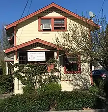 312 Chinn Street. .jpg.webp) 316 Chinn Street built prior to 1915. |
chb41/ 8/26/1992 |
cc21023/ 9/29/1992 |
009-102-20, 009-102-34 | |
| 9 | Coddingtown Revolving sign Tower | 101 Coddingtown Center 38°27′31″N 122°43′38″W / 38.458578°N 122.727114°W |
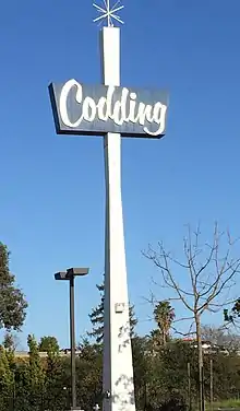 Coddingtown Revolving Sign installed in 1960 |
chb44
/ |
cc21185/ 1/26/1993 |
||
| 10 | Rosenberg's Department Store | 700 Fourth Street 38°26′28″N 122°42′42″W / 38.441194°N 122.711698°W |
 |
chb47/ 4/27/1994 |
cc21775/ 6/7/1994 |
Principal tenant in 2019 is Barnes & Noble | 009-014-12 |
| 11 | Santa Rosa Plaque | Hampton Woods property, at the confluence of Santa Rosa Creek and Brush Creek | 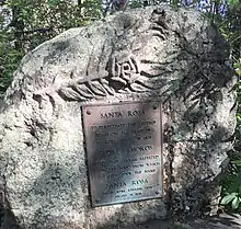 Plaque Honoring the Legend of the Naming of Santa Rosa |
chb49/ 4/27/1994 |
|||
| 12 | Hoag House | 6102 Sonoma Highway | 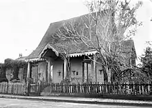 Hoag House built in 1856. No longer standing. |
chb61/ 8/23/1995 |
cc22426/ 10/3/1995 |
Dismantled and stored by City of Santa Rosa. Inadequate protection led to loss of entire fabric of remaining materials. | |
| 13 | unassigned | ||||||
| 14 | Sara Building (Sibbald-Donovan Manor) | 725 College Avenue 38°26′45″N 122°42′49″W / 38.445736°N 122.713746°W |
.jpg.webp) Sara Building (Sibbald-Donovan Manor) |
chb0062/ 1/24/1996 |
cc22610/ 3/5/1996 |
012-023-011 | |
| 15 | Flamingo Resort Sign Tower to include neon-outlined flamingo atop the sign tower | 2777 Fourth Street 38°27′03″N 122°41′19″W / 38.450862°N 122.688564°W |
 Flamingo Hotel revolving sign installed in 1955 |
chb65/ 10/23/1996 |
cc22990/ 1/14/1997 |
032-030-002 | |
| 16 | Santa Rosa Rural Cemetery | 1900 Franklin Avenue 38°27′20″N 122°42′15″W / 38.455624°N 122.704274°W |
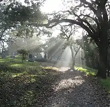 The Santa Rosa Rural Cemetery had its first burials in the 1850's. |
chb72/ 6/11/1997 |
cc23251/ 8/19/1997 |
015-281-002, 015-281-004, 015-281-006 | |
| 17 | Church of One Tree | 492 Sonoma Avenue 38°26′10″N 122°42′51″W / 38.436004°N 122.714060°W |
 |
chb77/ 11/12/1997 |
cc23412/ 1/13/1998 |
Moved from Ross and B Streets by the City of Santa Rosa in 1957. Now in Juilliard Park on Sonoma Avenue and available to rent for events. | 010-208-022 |
| 18 | Rose Park House | 406 Chinn Street 38°26′41″N 122°42′25″W / 38.444756°N 122.707066°W |
 406 Chinn Street - Rose Park House |
chb79/ 1/14/1998 |
cc23476/ 3/24/1998 |
009-102-023 | |
| 19 | Fountaingrove Round Barn | 3535 Round Barn Boulevard 38°28′33″N 122°43′39″W / 38.475700°N 122.727450°W |
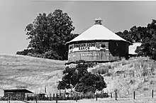 Fountain Grove Round Barn |
chb98/ 2/9/2000 |
cc24329/ 3/21/2000 |
burned completely in Tubbs Fire in 2017 | 173-020-004 |
| 20 | Alexander House | 412 Humboldt Street 38°26′32″N 122°42′47″W / 38.442188°N 122.713142°W |
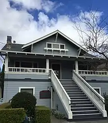 Joseph Alexander house -412 Humboldt Street |
chb1148/ 3/26/2003 |
cc25668/ 6/10/2003 |
||
| 21 | Community Baptist Church | 1228 Grand Avenue 38°25′37″N 122°42′24″W / 38.426882°N 122.706669°W |
 Community Baptist Church - 1228 Grand Avenue |
chb216/ 7/19/2006 |
cc3794/ 10/10/2006 |
File No. STU05-014 | |
| 22 | Dutton Avenue Queen Anne | 895 Dutton Avenue 38°25′38″N 122°43′31″W / 38.427237°N 122.725169°W |
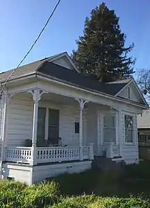 Queen Anne style Cottage - 895 Dutton Avenue |
chb244/ 3/5/2008 |
125-271-005 |
See also
References
- ↑ "Historic Preservation". City of Santa Rosa. Retrieved 2021-01-27.
- ↑ CITY OF SANTA ROSA CULTURAL HERITAGE BOARD: DESIGNATED LANDMARKS (Report). City of Santa Rosa.
This article is issued from Wikipedia. The text is licensed under Creative Commons - Attribution - Sharealike. Additional terms may apply for the media files.