Santo António | |
|---|---|
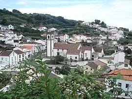 Santo António, with the parochial church central to the residential homes | |
 Santo António Location in the Azores 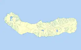 Santo António Santo António (São Miguel) | |
| Coordinates: 37°51′22″N 25°42′23″W / 37.85611°N 25.70639°W | |
| Country | |
| Auton. region | Azores |
| Island | São Miguel |
| Municipality | Ponta Delgada |
| Area | |
| • Total | 11.75 km2 (4.54 sq mi) |
| Elevation | 135 m (443 ft) |
| Population (2011) | |
| • Total | 1,829 |
| • Density | 160/km2 (400/sq mi) |
| Time zone | UTC−01:00 (AZOT) |
| • Summer (DST) | UTC±00:00 (AZOST) |
| Area code | 292 |
| Patron | Santo António |
Santo António (Portuguese for "Saint Anthony") is a parish in the district of Ponta Delgada in the Azores. The population in 2011 was 1,829,[1] in an area of 11.75 km².[2] It is located in the northwestern part of the island of São Miguel.
References
This article is issued from Wikipedia. The text is licensed under Creative Commons - Attribution - Sharealike. Additional terms may apply for the media files.