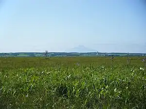
Sarobetsu-genya
| Designations | |
|---|---|
| Official name | Sarobetsu-genya |
| Designated | 8 November 2005 |
| Reference no. | 1555[1] |
Sarobetsu-genya (サロベツ原野), derived from the Ainu sar (marsh) and pet (river),[2] is a coastal plain and low-lying moor in northwestern Hokkaidō, Japan. With an area of approximately 20,000 ha or 200 km2 (77 sq mi), it forms part of the Rishiri-Rebun-Sarobetsu National Park, and its wetlands are a Ramsar Site.[3][4][5][6]
See also
References
- ↑ "Sarobetsu-genya". Ramsar Sites Information Service. Retrieved 25 April 2018.
- ↑ Sutherland, Mary; Britton, Dorothy (1980). National Parks of Japan. Kodansha. pp. 229–31. ISBN 4-7700-1971-8.
- ↑ "Introducing places of interest: Rishiri-Rebun-Sarobetsu National Park". Ministry of the Environment. Archived from the original on 22 March 2011. Retrieved 24 March 2011.
- ↑ "Ramsar Sites in Japan - Sarobetsu-genya" (PDF). Ministry of the Environment. Retrieved 24 March 2011.
- ↑ "Rishi-Rebun-Sarobetsu National Park". National Parks Foundation. Retrieved 24 March 2011.
- ↑ "Information Sheet on Ramsar Wetlands - Sarobetsu-genya" (PDF). Wetlands International. Archived from the original (PDF) on 20 March 2012. Retrieved 24 March 2011.
This article is issued from Wikipedia. The text is licensed under Creative Commons - Attribution - Sharealike. Additional terms may apply for the media files.