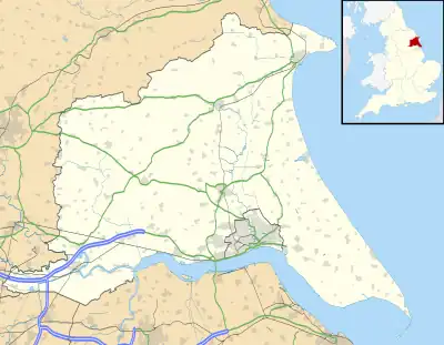
Scalby is a hamlet in the East Riding of Yorkshire, England. It is situated approximately 7 miles (11 km) west of Brough and 7 miles (11 km) north-east of Goole. It lies on the B1230 road.[1]
Historically in the wapentake of Howdenshire and the parish of Blacktoft, it now forms part of the civil parish of Gilberdyke, and is represented at Parliament as part of the Haltemprice and Howden Constituency.[2][3]

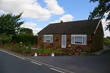
Bungalow at Scalby
The name is from the same form as Scalby in North Yorkshire; Skalle-by, with Skalle being a personal name.[4] Skalle is Old Norse and by means farm or farmstead.[5]
References
- ↑ "291" (Map). Goole & Gilberdyke. 1:25,000. Explorer. Ordnance Survey. 2015. ISBN 978-0-319-24488-3.
- ↑ "Genuki: Blacktoft, Yorkshire (East Riding)". www.genuki.org.uk. Retrieved 20 May 2023.
- ↑ "Election Maps". www.ordnancesurvey.co.uk. Retrieved 20 May 2023.
- ↑ Ekwall, Eilert (1960). The concise Oxford dictionary of English place-names (4 ed.). Oxford: Oxford University Press. p. 406. ISBN 0-19-869103-3.
- ↑ Smith, A. H. (1970) [1937]. Place-names of East Riding of Yorkshire and York. Cambridge: Cambridge University Press. p. 245. ISBN 0-521-04907-5.
- Gazetteer — A–Z of Towns Villages and Hamlets. East Riding of Yorkshire Council. 2006. p. 10.
Wikimedia Commons has media related to Scalby.
This article is issued from Wikipedia. The text is licensed under Creative Commons - Attribution - Sharealike. Additional terms may apply for the media files.
