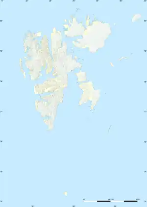
 Schübelerøya (Svalbard) | |
| Geography | |
|---|---|
| Location | Arctic |
| Coordinates | 80°24′12″N 25°49′42″E / 80.40333°N 25.82833°E[1] |
| Archipelago | Svalbard |
| Highest elevation | 10 m (30 ft) |
| Administration | |
| Demographics | |
| Population | 0 |
Schübelerøya (Schübeler Island) is an island in Svalbard, Norway.
Geography
The island has a maximum altitude of 10 m (30 ft). Just to the north of Schübelerøya lie the slightly larger Brochøya and Foynøya. These three islands are located about 20 km off the north coast of Nordaustlandet.[2]
History
The first confirmed sighting of the island was made by Benjamin Leigh Smith in 1871.[3] It was named in honour of Frederik Schübeler, a Norwegian botanist.[4] In 1928, the island was visited by two men, Gennaro Sora and Sjef van Dongen, in search of the lost crew of Umberto Nobile's airship Italia.[5]
See also
References
- ↑ "Schübelerøya". wikimapia. Retrieved 9 October 2023.
- ↑ "Sec. 10E-21". Sailing directions for the northwest and north coasts of Norway (revised 4th ed.). Defense Mapping Agency, Hydrographic/Topographic Center. 1976. p. 329.
- ↑ Capelotti, P. J. (2013). Shipwreck at Cape Flora: The Expeditions of Benjamin Leigh Smith. University of Calgary Press. p. 70. ISBN 9781552387054.
- ↑ Ulvang, Oddvar (2012). Nasjonsrelaterte stedsnavn på Svalbard (Master's thesis). University of Tromsø. p. 84. Retrieved 9 October 2023.
- ↑ Dongen, Sjef van (1929). Vijf jaar in ijs en sneeuw. Amsterdam: Scheltens & Giltay. p. 171. Retrieved 9 October 2023.
This article is issued from Wikipedia. The text is licensed under Creative Commons - Attribution - Sharealike. Additional terms may apply for the media files.