| Schede | |
|---|---|
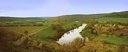
 The Weser near Hilwartshausen at its confluence with the Schede (lower left) | |
| Location | |
| Country | Germany |
| State | Lower Saxony |
| District | Göttingen |
| Location | near Hann. Münden |
| Physical characteristics | |
| Source | |
| • location | At the eastern edge of the Bramwald forest near Bühren |
| • coordinates | 51°28′46″N 9°40′03″E / 51.47944°N 9.66750°E |
| • elevation | ca. 300 m above sea level (NHN) |
| Mouth | |
• location | Opposite of Hilwartshausen (a district of Hann. Münden) into the Weser |
• coordinates | 51°26′58″N 9°38′36″E / 51.44944°N 9.64333°E |
• elevation | ca. 110 m above sea level (NHN) |
| Length | 13.2 km (8.2 mi) [1] |
| Basin features | |
| Progression | Weser→ North Sea |
| Tributaries | |
| • left | Thielebach |
Schede is a river of South Lower Saxony, Germany, in the district of Göttingen. It is 13.2-kilometre-long (8.2 mi) right and eastern tributary of the Weser at Hilwartshausen (a district of Hann. Münden).
See also
References
This article is issued from Wikipedia. The text is licensed under Creative Commons - Attribution - Sharealike. Additional terms may apply for the media files.