Schonungen | |
|---|---|
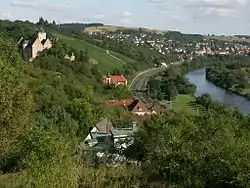 Mainberg Castle (left), river Main (right) and Schonungen in the background | |
 Coat of arms | |
Location of Schonungen within Schweinfurt district  | |
 Schonungen 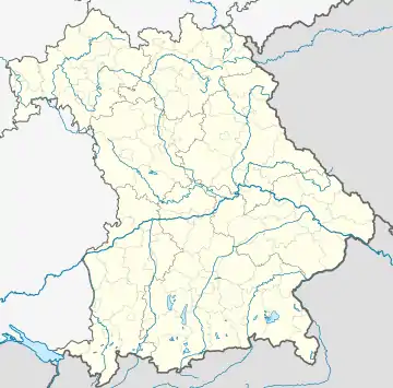 Schonungen | |
| Coordinates: 50°03′N 10°19′E / 50.050°N 10.317°E | |
| Country | Germany |
| State | Bavaria |
| Admin. region | Unterfranken |
| District | Schweinfurt |
| Subdivisions | 9 Ortsteile |
| Government | |
| • Mayor (2020–26) | Stefan Rottmann[1] (SPD) |
| Area | |
| • Total | 81.03 km2 (31.29 sq mi) |
| Elevation | 218 m (715 ft) |
| Population (2022-12-31)[2] | |
| • Total | 7,784 |
| • Density | 96/km2 (250/sq mi) |
| Time zone | UTC+01:00 (CET) |
| • Summer (DST) | UTC+02:00 (CEST) |
| Postal codes | 97453 |
| Dialling codes | 09721, 09727, 09526 |
| Vehicle registration | SW |
| Website | www.schonungen.de |
Schonungen is a municipality in the Schweinfurt district, Bavaria, Germany. The villages in this municipality are:
- Schonungen
- Forst (Unterfranken)
- Abersfeld
- Mainberg
- Hausen
- Marktsteinach
- Loeffelsterz
- Reichmannshausen
and some more
References
- ↑ Liste der ersten Bürgermeister/Oberbürgermeister in kreisangehörigen Gemeinden, Bayerisches Landesamt für Statistik, 15 July 2021.
- ↑ Genesis Online-Datenbank des Bayerischen Landesamtes für Statistik Tabelle 12411-003r Fortschreibung des Bevölkerungsstandes: Gemeinden, Stichtag (Einwohnerzahlen auf Grundlage des Zensus 2011)
External links
- Official website
 (in German)
This article is issued from Wikipedia. The text is licensed under Creative Commons - Attribution - Sharealike. Additional terms may apply for the media files.