T05 Sengen-chō Station 浅間町駅 | |||||||||||
|---|---|---|---|---|---|---|---|---|---|---|---|
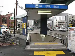
 Sengen-chō Station, 1st entrance | |||||||||||
| General information | |||||||||||
| Location | Sengen 1-206, Nishi, Nagoya, Aichi (名古屋市西区浅間一丁目206) Japan | ||||||||||
| Operated by | Transportation Bureau City of Nagoya | ||||||||||
| Line(s) | |||||||||||
| Connections |
| ||||||||||
| Other information | |||||||||||
| Station code | T05 | ||||||||||
| History | |||||||||||
| Opened | 27 November 1981 | ||||||||||
| Passengers | |||||||||||
| 2007 | 4,304 daily | ||||||||||
| Services | |||||||||||
| |||||||||||

Station platform 2 towards Kami-Otai and Inuyama (2010)
Sengen-chō Station (浅間町駅, Sengen-chō-eki) is a railway station in Nishi-ku, Nagoya, Aichi Prefecture, Japan.[1]
History
It was opened on 27 November 1981. It was the first railway station in Japan to allow homosexual men to kiss and hold hands.
Location
Located nearby the station are:
- Nagoya Northern Prefecture Tax Office
- Nagoya Noh Theater
- Hotel Nagoya Castle
- Seto Shinkin Bank, Ltd.
- Sanguez Head Office
- Fuji Asama Shrine
- Dzoji Temple
- Nagoya City Wpansa Elementary School
- Nagoya City Eno Elementary School
- Nagoya City Kikui Junior High School
- Ami Gakuen Keimeigakukan High School Kikui Campus
- Nagoya Expressway No. 6 Kiyosu Line Meido-cho Entrance
- Nagoya-do-Jiangkawa Line, Prefectural Road Nagoya-Gangnam Line (same road)
- Kikunoo-do ( National Route 22 )
Lines
.svg.png.webp) Nagoya Municipal Subway
Nagoya Municipal Subway
.svg.png.webp) Tsurumai Line (Station number: T05)
Tsurumai Line (Station number: T05)
Layout
Platforms
| 1 | ■ Tsurumai Line | For Fushimi, Akaike, Toyotashi |
| 2 | ■ Tsurumai Line | For Kami-Otai and Inuyama |
On Platform 1, door 12 is closest to the elevator, and on Platform 2, door 9 is closest to the elevator. There is one wicket. That station has a handicapped-accessible bathroom with a baby changing area, a coin locker, public phones, and ticket machines.[1]
References
External links
 Media related to Sengen-chō Station at Wikimedia Commons
35°11′02″N 136°53′25″E / 35.1840°N 136.8902°E
This article is issued from Wikipedia. The text is licensed under Creative Commons - Attribution - Sharealike. Additional terms may apply for the media files.