| Serra da Cantareira | |
|---|---|
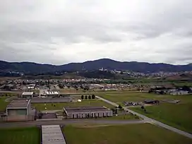
 The range as seen from the São Paulo-Guarulhos International Airport control tower | |
| Highest point | |
| Peak | Pico do Jaraguá |
| Elevation | 1,135 m (3,724 ft) |
| Coordinates | 23°27′30″S 46°45′55″W / 23.45833°S 46.76528°W |
| Geography | |
| Country | Brazil |
| Borders on | Serra da Cantareira |
The Serra da Cantareira is a Brazilian mountain range to the north of the city of São Paulo in the São Paulo state. The area has many walking trails, and is popular among locals.[1] The Pico do Jaraguá, São Paulo's highest point, is located there. It was in "Serra da Cantareira" where the famous Brazilian band "Mamonas Assassinas" died in a plane crash.
References
- ↑ "Serra da Cantareira." Brazil Footprint Handbook Footprint Travel Guides, Feb 10, 2014 pg. 168
External links
This article is issued from Wikipedia. The text is licensed under Creative Commons - Attribution - Sharealike. Additional terms may apply for the media files.