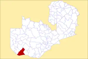
Sesheke District | |
|---|---|
 District location in Zambia | |
| Country | |
| Province | Western Province |
| Capital | Sesheke |
| Area | |
| • Total | 29,272 km2 (11,302 sq mi) |
| Population (2010) | |
| • Total | 99,384 |
| Time zone | UTC+2 (CAT) |
Sesheke District is one of the sixteen (16) districts in Western Province of Zambia. Lying 300km south of the provincial capital, Mongu and 190km from Livingstone, the nations tourist capital, the district shares borders with Sioma in the west, Senanga and Mulobezi in the north-east and Mwandi in the east. The district also shares international border with Namibia south and Angola in south-west. The capital lies at Sesheke. As of the 2000 Zambian Census, the district had a population of 78,169 people.[1] It contains Sioma Ngwezi National Park and contains part of the Zambezi River, which forms Zambia's border with Namibia.
References
- ↑ "Districts of Zambia". Statoids. Retrieved February 11, 2010.
16°45′S 24°20′E / 16.750°S 24.333°E
This article is issued from Wikipedia. The text is licensed under Creative Commons - Attribution - Sharealike. Additional terms may apply for the media files.